

Despite Lawrence’s reassurances I admit to being apprehensive as I set of to conquer the Cape. Over a thousand kilometres of notoriously rough roads and it was coming to the end of the dry season which meant the roads were at their worst, and if the rains arrived early I could get stranded for months! Ironically for such an arid place it seems the whole of northern Queensland is flood prone in the wet.
Not only that but despite his All-Terrain credentials Max is not Toyota tough and I didn’t want to beat him to death before we even started the circumnavigation together.
So it was with these misgivings rattling around in my head that I started my ascent! After a relaxing morning, walking Banjo and visiting Rusty’s markets in Cairns I headed off around midday, with no particular destination in mind and expecting to listen to and possibly stop by a pub and watch the Swans win the AFL Grand Final!
Climbing up from Cairns to Kuranda is as long and winding as it was coming down from Atherton a few days earlier, and when we finally reached the top I thought I’d reward myself with a visit to Barron falls and give Max a chance to catch his breath after a brutal hill climb up from Cairns. This proved to be a good decision as Barron falls was better than expected and the walk to get to them via an elevated walkway through rainforest was well worth the effort.


Refreshed and revitalised we headed north listening to all the pre-GF banter and heartened by the fact that most of the experts were tipping a Swans victory. Settling in for what I’d thought would be an entertaining drive with the prospect of pulling into a country pub to watch the final quarter to see the Swans hoist the premiership trophy, but it didn’t quite go to plan. Firstly, not far north of Mareeba I ran out of mobile range and the radio went dead, no matter I’d pull into the next pub to get a score update and possibly pull up a stool.
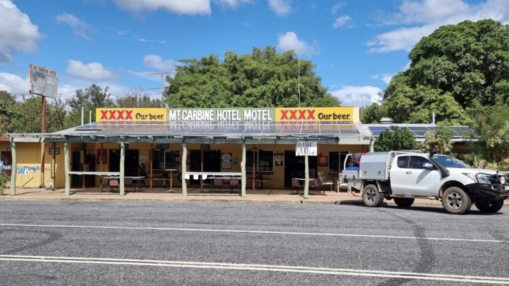
Let me tell you there isn’t much north of Mareeba, I was surprised how quickly to country turned to scrub and at the lack of any semblance of civilisation. Approaching Mount Carbine my spirits were lifted on noticing a sign to Lighthouse Mountain (how prophetic), and even more so by the fact we were travelling beside the Mount Lewis National Park (which despite my surname I’d never heard of). Taking these to be good omens I pulled up and went into the local pub, announcing myself as a Swans supporter to the 10 or 12 people who were all clad in maroon. I was surprised at the warmth of my reception, and on glancing at the score I understood why, another goal to Brisbane and it looked like the game was over before half time. Not wanting to hang around for what was shaping up as a flogging I bid adieu to the men in maroon and promptly headed for the exit!

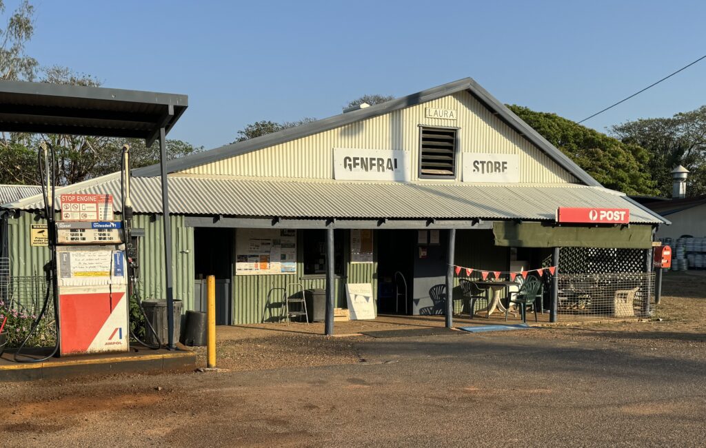
Realising I wouldn’t be celebrating a Swans victory in a pub along the way I looked at the map to see where I might overnight. Initially Lakeland looked promising as it was about an hour and a half up the road but on arrival I quickly realised it was good for one thing only, refueling! The next town was Laura, a further hour away and on first impressions it didn’t seem to be much better than Lakeland and I thought about pushing on to the Hann River Roadhouse another half hour up the road. But as I pulled back out onto the highway I noticed the sun was setting and not wanting a repeat of animal encounters I decided a strategic retreat to the Laura pub and campground was in order. As it turned out this was a good move because not only was the pub and campground better than I expected but when I passed Hann River the next day it was a hole (not to put too finer point on it)!

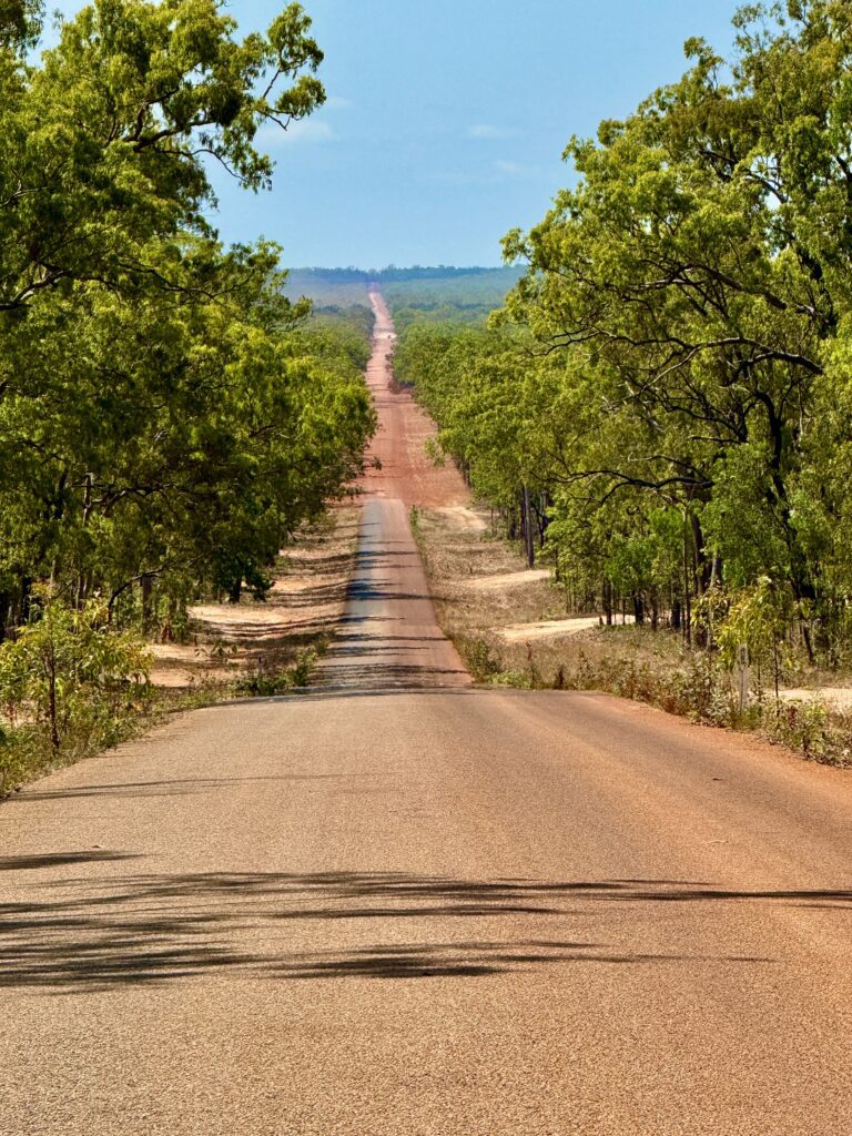
Waking on Sunday morning I knew this was going to be a very big day! It was about 230km to Coen and Lawrence had warned me the worst part of the road was either side of Coen, and then about the same distance to my intended destination at Bramwell Junction Roadhouse, over 450kms of mainly corrugated dirt road through pretty uninspiring country. I had deliberately planned to run this section on a Sunday in the hope of minimising the prevalence of road trains heading in the opposite direction with their trailing clouds of dust and windscreen shattering rocks.


About 20kn out of Laura the black top went red and the realisation that there was still over 200km to Coen and by all accounts the road got worse was not an uplifting thought. About a 100km further on we got to Musgrave and it was a relief to know that this is where Lawrence suggested I turn off on my way south to head to Cooktown, knowing that I wouldn’t have to travel this road again but not knowing what the road to Cooktown would be like? A reasonable $8 coffee at Musgrave was a welcome relief even if the sign on the fence wasn’t exactly welcoming to dog owners, and with Diesel clocking in at $2.95/litre and a line of thirsty looking Toyota’s waiting for a drink I decided to head on to Coen.


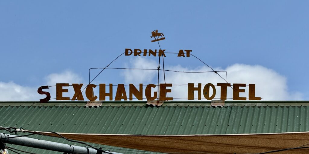
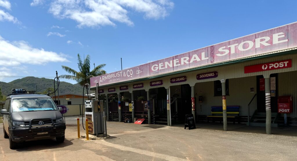
This next 109kms was the worst yet, all bull dust and corrugations and curiously named (or unnamed) creek, and at the end of it all Coen. Another miserable little town in the middle of nowhere with it’s singular claim to fame being the rebranded Sex-change Hotel. Even though it was just after 11.00am there wasn’t a soul in sight, just a mangey looking dog and a grumpy man of few words at the General Store where I refuelled at a slightly less exorbitant price.


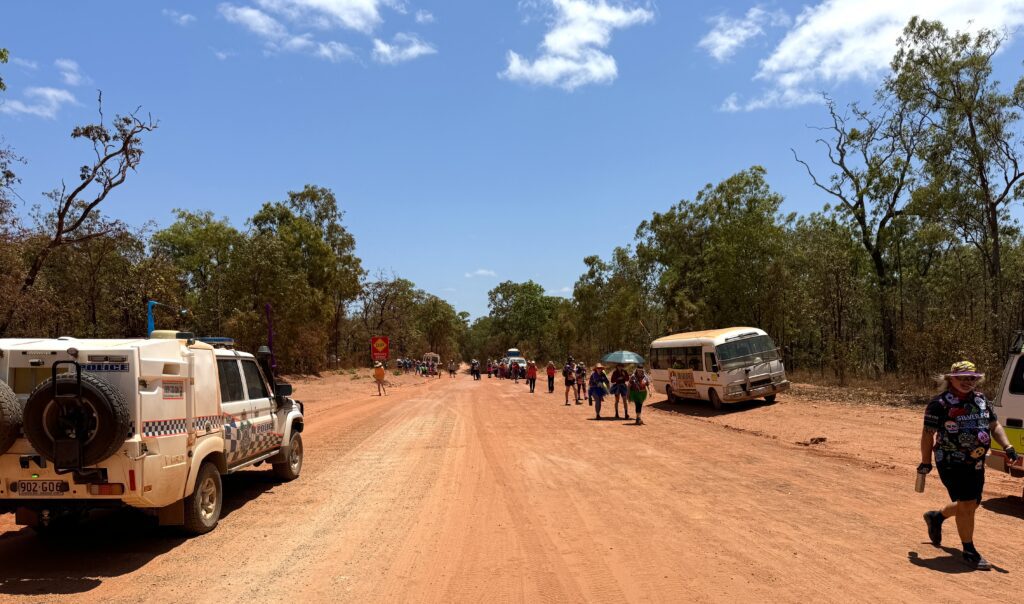
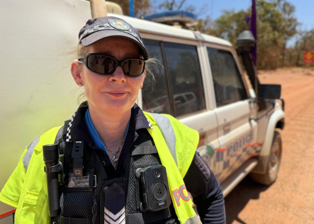
Feeling pleased to have half the day’s trip behind me and to be leaving Coen I hit the road again and after about 30kms was alarmed to see multiple flashing lights and a number of cars and busses pulled to the side of the road ahead. Fearing the worst I slowed to a crawl and approached a police lady standing by her vehicle, enquiring if everything was ok. I was relieved when she said she was chaperoning a charity walk in aid of suicide prevention, and shortly after I stopped around 300 people emerged from the bush heading back toward Coen. Evidently there had been a spate of young local guys taking their own lives recently and this worthy cause called “Conquering the Corrugations” is focussing on regional mental health and teaching how to deal with life’s up’s and down’s https://www.conquerthecorrugations.com.au

After finally arriving at the Weipa turn off I was amazed to notice that the Piccaninny Plains station is owned by the Australian Wildlife Conservancy and run as a wildlife sanctuary. Two friends and business associates of mine are heavily involved with the AWC and this is also an extremely worthy cause and also well worth supporting www.australianwildlife.org

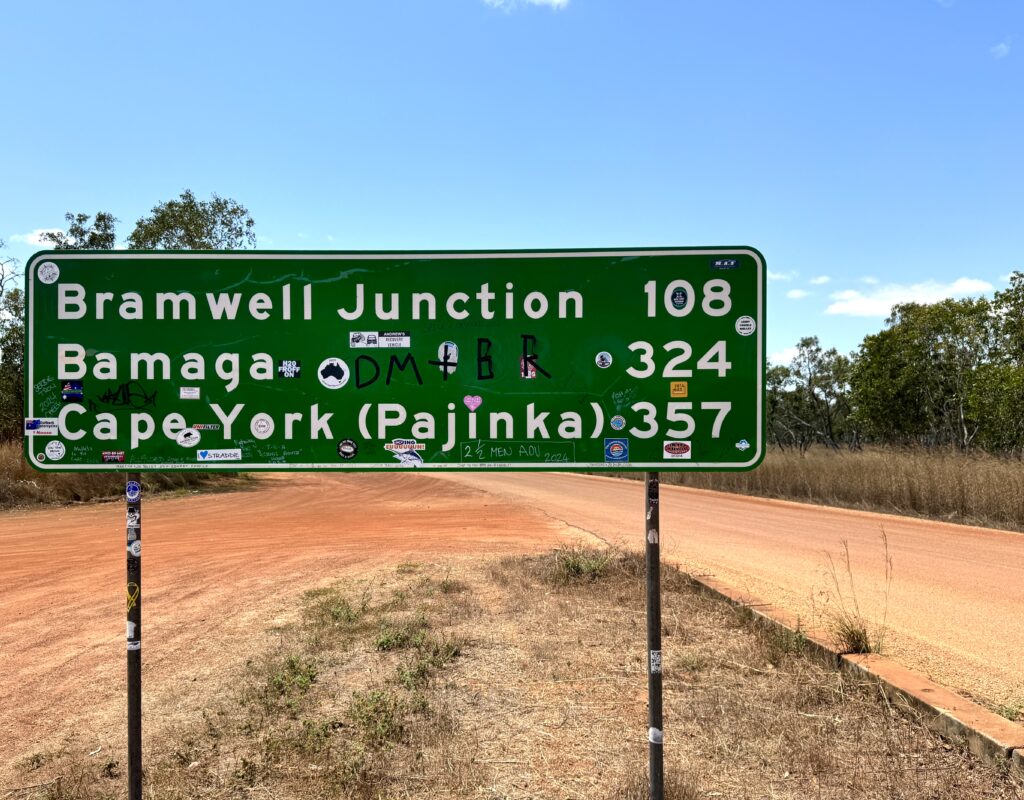
Now on the home stretch to my overnight destination at Bramwell Junction I was fearing the worst as the main road went to Weipa, on the map it looked daunting, 108 kms of dirt, but was very pleasantly surprised when I discovered this stretch had recently been graded and was by far the best dirt road I’d been on all day, no corrugations or traffic, 100kph all the way and an hour later I was at Bramwell!

The other thing that amazed me on this stretch were the termite mounds, it’s almost as if Antoni Gaudi came to the Queensland outback for inspiration for la Sagrada Familia, these things are architectural wonders, and some are surprisingly big up to 5m, and plentiful, there are literally millions of them!


Glad to have the day’s travels behind me I celebrated with a steak sandwich at 5.30pm (when last orders were taken) and a couple of cold ones which were momentarily interrupted when a dingo strode past me without an apparent care in the World!

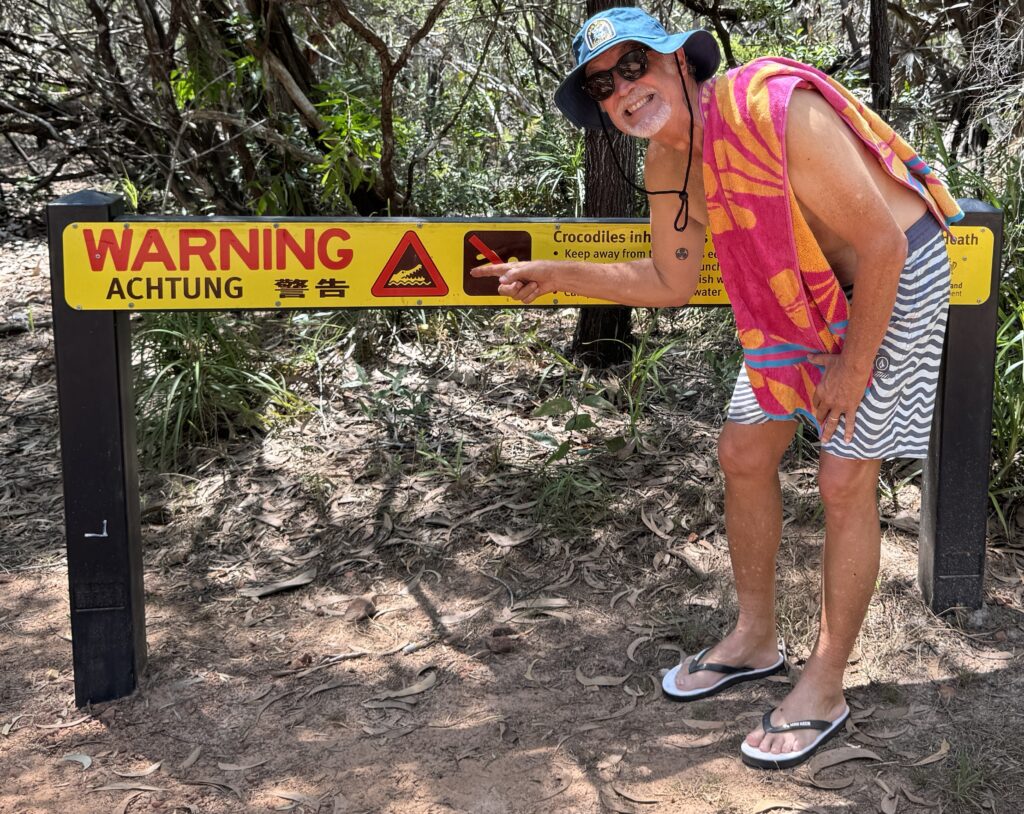
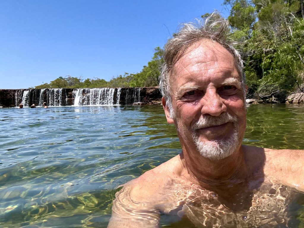
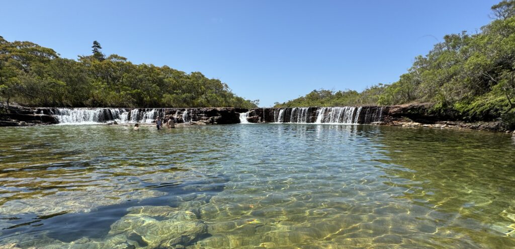
Bramwell Junction is where the Old Telegraph Road, the original road north and a notorious hard core 4X4 track and the newer Northern By-Pass Road diverge and on leaving Bramwell I was encouraged by being told the next leg to the Jardine River ferry was as good as the last 108km from the Weipa turnoff. It was a lie, some of the road was ok and some was shite. After another 109kms which seemed to take forever we arrived at Fruit Bat Falls which Lawrence had recommended and said was the only crocodile free swimming hole on the peninsular. I had to double check the sign at the turn off initially thinking it said 27kms but was very relieved that on closer inspection it said 2.7kms which was a good thing as that 2.7kms may be the worst road in Australia. However, on arrival, and despite the crocodile warning sign this was an absolute oasis and turned out to be one of the most enjoyable swims I have ever had!

After cooling my heels and dragging myself away it was back in the saddle for the 58km stretch to the Jardine River ferry. After initially taking a wrong turn and accidently getting on the Old Telegraph Road which is more of a goat track than a road I thought this is going to be a very looong 58Km, but after a couple of minutes I realised my mistake and backtracked to the much better but still rough By-Pass Rd.
On arrival at the Jardine River ferry I was initially shocked to discover the ferry fee was $ 123 return and equally surprised to find the ferryman had just gone to lunch and the next ferry would be in an hour. Oh well VFNQ time I guess (guess what the V stands for and the F doesn’t stand for “Far”)!

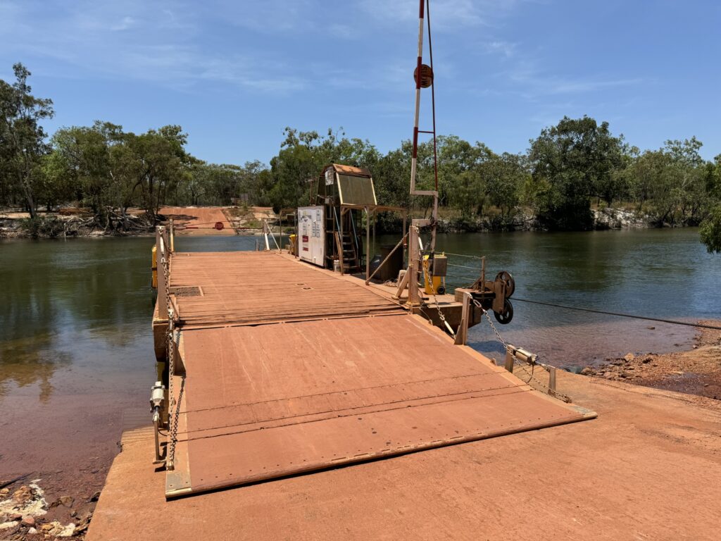

I was also surprised and rather pleased to see that the communities north of the Jardine river were alcohol free and penalties for bringing booze across the rive could exceed $75,000 and a year in the slammer. No one had mentioned this but I totally support this as grog seems to be the black fella’s curse.
Finally the ferryman decided to grace us with his presence and we chugged across the river to be greeted by an abomination of a road. The 42 kms into Bamaga were the worst by far of the whole trip and I was reminded of the old mountaineering adage, the close you are the harder it gets, the road to Bamaga was a shocker. But worse was yet to come!!!
On reaching Bamaga I mistakenly thought I was within spitting distance of “the Tip” and I half expected a metered carpark and paved path to Pajinka the northern most point of the Australian mainland. Wrong!
Bamaga makes Fiji seem like New York, so laid back it comatose, unbridled horses walking down the main street, everybody smiling and waving, and nobody doing much of anything. I finally found the only service station in town which, despite advertising “Fuel 24/7” was closed for stocktake?
After driving around town for a few minutes, and even heading out to the nearby port of Seisia I finally found someone to ask how to get to Pajinka and was surprised to learn that the turnoff was beside the BP service station I’d been at earlier.
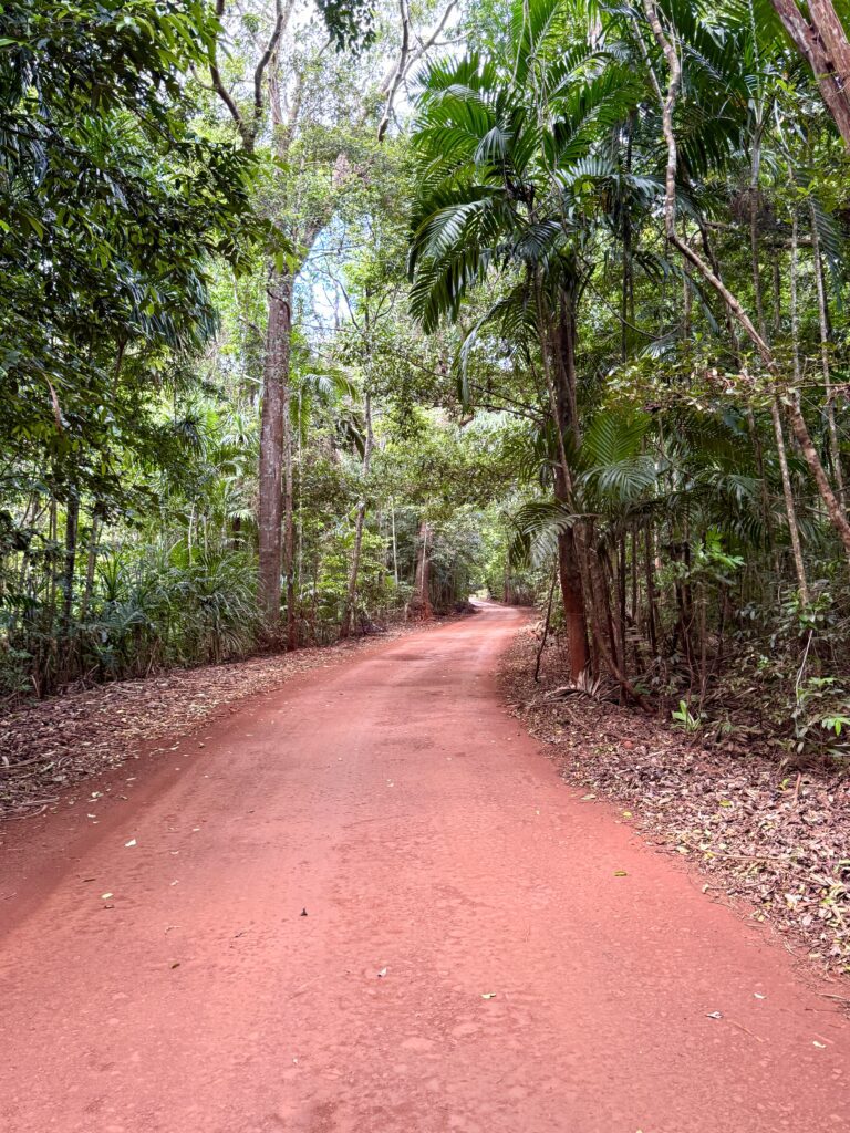
So back I went and realised why I’d missed it first time, it’s an inconspicuous dirt track on the outskirts of town, and Pajinka was still 33kms away! To say the last few steps are the hardest would be an understatement, the road was ridiculous, a single track through dense rainforest, and the final hurdle, a deep creek crossing that no one had mentioned! I hadn’t come this far to be beaten within sight of my destination so without knowing what to expect I tentatively drove Max into plunged the muddy creek which seemed to get deeper the further I went. Fearing disaster I was mightly relieved when he dragged himself out the other side, and not wanting to think about the return crossing I charged on. Finally after a further 5kms the road ended in a rather nondescript gravel parking lot with no signs or directions, and no obvious path to the fabled Pajinka.


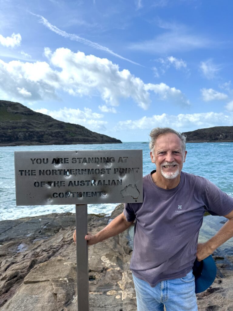
After clambering up a barren rock face which felt like scaling Uluru back in 2018, I found a trail of sorts which led to a stone cairn which pointed to various places in the World and told you how far you were from them, I discovered I was exactly 2,724kms from Sydney as the crow flies, but strangely it didn’t tell me in which direction Pajinka was. After a bit more wandering around I finally saw what I was looking for, the famously understated sign that tells you are the most northerly person on the Australian continent. However, on closer inspection it looked more like a cheese grater than the famous sign it was meant to be as someone had decided to use it for target practice and it was riddled with heavy calibre bullet holes!

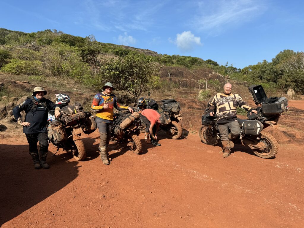
As I returned from “The Tip” a bunch of guys arrived on dirt bikes and loudly proclaimed that they’d just completed a ride from South East Cape in Tasmania, which is evidently Australia’s most southerly point, to you know where! Understandably they were in high spirits, and told me that after a night in their swags they were turning around and heading back from whence they came. Good luck to them I thought!

Having conquered the Cape I retired to Loyalty Beach camp site for a well earned…sausage roll! (ok, it was a bucket of prawns actually, with apologies to AC/DC)!


Leave a Reply


")