

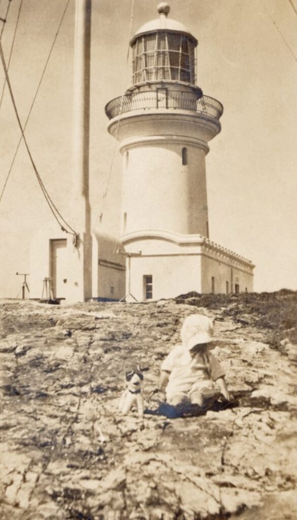
Note: Unfortunately I was unable to visit the island due to the fact it was off-limits for sea bird breading season but I intend visiting early in the new year. The photos accompanying this report are stock shots.
Location:
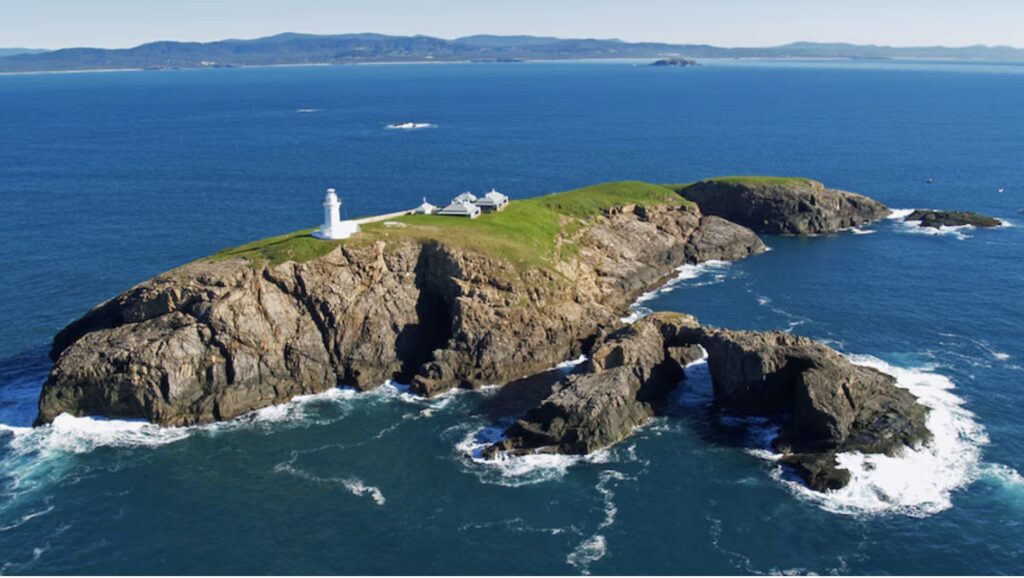
South Solitary Island Lighthouse stands on South Solitary Island, located approximately 15 kilometers northeast of Coffs Harbour, New South Wales. The island is small, rocky, and extremely isolated, rising about 40 meters above sea level with sheer cliffs on all sides. It measures roughly 400 meters north-south and 200 meters east-west, with a total area of just 11 hectares. The island is part of a group known as the Solitary Islands, which form a chain extending from North Solitary Island to Split Solitary Island, marking a particularly hazardous stretch of the NSW coast where warm and cold ocean currents meet.
The lighthouse stands on the highest point of the island, positioned to provide maximum visibility along this treacherous stretch of coastline. The site was chosen despite its difficult access because of its strategic position and elevation, which allows the light to be visible for many nautical miles in all directions.
Summary:
GPS: Lat: 30° 12′ S : Long: 153° 16′ E
First Lit: March 18, 1880; (Automated & Demanned 1975)
Tower height: 20m
Focal Height: 58m above mean sea level
Original Lens: First Order Chance Brothers dioptric lens
Intensity: 380,000 candela
Range: 15 nml
Characteristic: One White flash every 5 seconds [Fl.W. 5s]
History:
Indigenous:
The Gumbaynggirr people are the traditional custodians of the coastal region adjacent to South Solitary Island and the surrounding waters. While the island itself was not permanently inhabited by Indigenous people due to its isolation and difficult access, the surrounding waters were important fishing grounds and featured prominently in local cultural practices.
The Solitary Islands feature in Gumbaynggirr dreaming stories, particularly relating to marine life and ocean navigation. According to traditional stories, the islands were created during the dreamtime when a great warrior was turned to stone while fishing. The separate islands represent pieces of his canoe and fishing equipment that were scattered by the waves.
The waters around the Solitary Islands were traditionally rich fishing grounds, with the Gumbaynggirr people developing sophisticated knowledge of the currents, tides, and marine life in the area. Archaeological evidence suggests that the mainland areas opposite the islands were significant camping and ceremonial sites.
Colonial:
Lieutenant James Cook noted the Solitary Islands during his voyage up the east coast in 1770, naming them for their isolated appearance. In his journal, he wrote of the dangerous reefs and currents in the area, marking it as a place to be avoided by shipping.
The first detailed survey of the area was conducted by John Oxley in 1823 aboard the Mermaid. His report emphasized the dangers of the region and the need for reliable navigation aids. As maritime traffic increased along the coast in the early 1800s, the island group became notorious for shipwrecks. The growing importance of coastal shipping, particularly related to the cedar-getting industry and later agricultural exports, led to increased pressure for a lighthouse in the 1860s.
The decision to build the lighthouse was finally made in 1878 after several major shipping disasters in the vicinity. The colonial government allocated £37,000 for the construction, a substantial sum for the time, reflecting the importance placed on improving maritime safety in the region.

The Lighthouse:
The lighthouse was designed by James Barnet, Colonial Architect of New South Wales, as part of his systematic approach to lighting the NSW coast. The design had to account for the extreme isolation and weather conditions of the site. Construction began in 1879 under the supervision of contractor William Douglas.
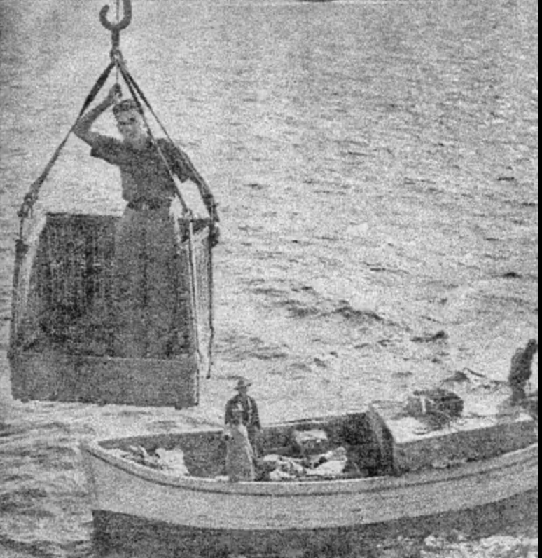
Construction was particularly challenging due to the island’s isolation and exposed position. All materials had to be landed by boat in a small cove on the southern side of the island and hauled up the steep cliffs using a flying fox system. The landing of materials could only be attempted in the calmest weather conditions, leading to frequent delays in construction.
The construction process itself was a remarkable feat of engineering for its time. Workers lived in temporary camps on the island during construction, enduring difficult conditions and isolation. The project required innovative solutions to problems of water supply, material transport, and worker accommodation.


The Structures:
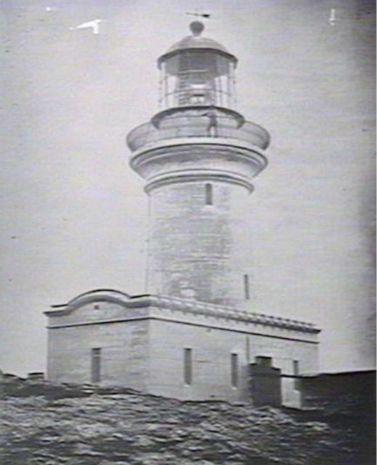
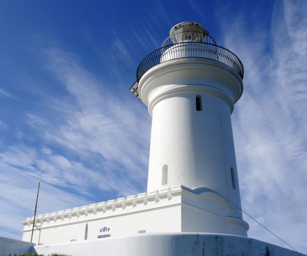
The tower is constructed of precast concrete blocks, representing one of the earliest uses of this material for lighthouse construction in Australia. The blocks were manufactured on the mainland and transported to the island. Each block was carefully shaped to include a tongue and groove system for secure fitting.
The tower is cylindrical, slightly tapering, with walls nearly a meter thick at the base reducing to 0.45 meters at the top. It stands 16 meters high and is painted white with a red lantern room. The lighthouse features a cantilevered gallery around the lantern room, providing access for maintenance and lens cleaning.
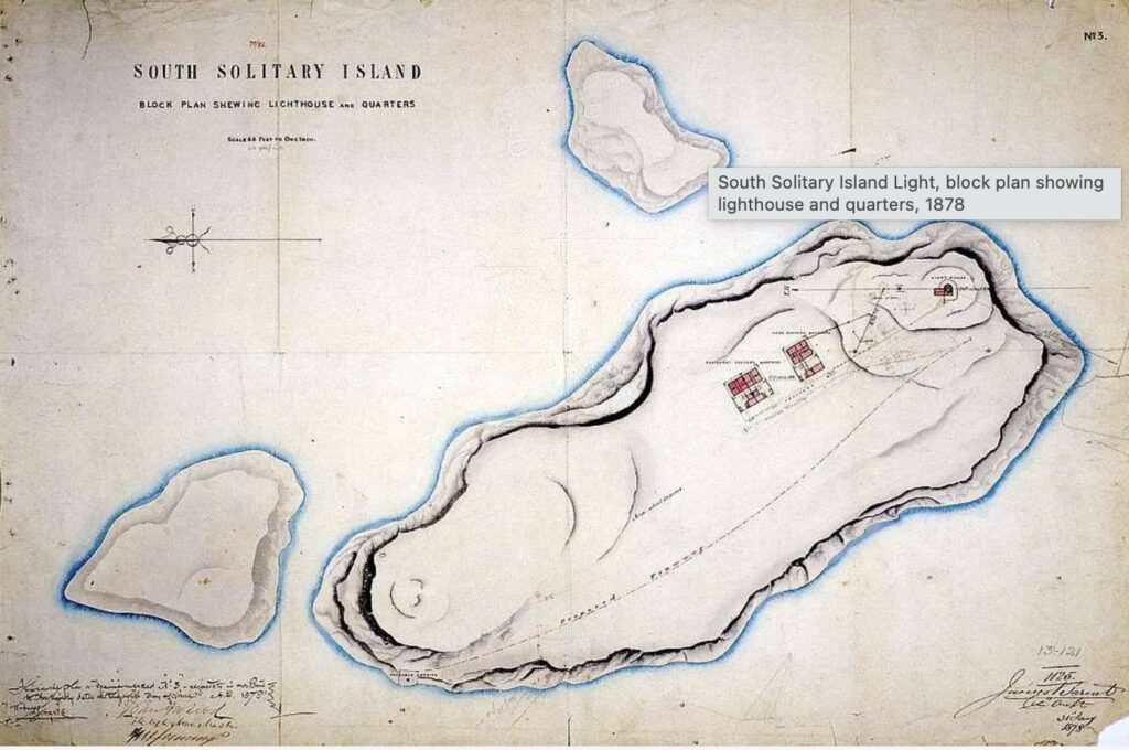
The lighthouse complex was designed as a self-contained community and included a Head keeper’s quarters, two assistant keepers’ cottages, a store building, signal house, workshop, stables, a school room and various outbuildings for livestock and storage.
All buildings were constructed of precast concrete blocks with iron roofs, designed to withstand the extreme weather conditions. The complex included underground water tanks with a total capacity of 150,000 liters, essential for the station’s self-sufficiency.
A unique feature was the construction of covered walkways between major buildings, allowing movement during severe weather. The entire station was encircled by a stone wall to provide some protection from the elements.
Technical Details:
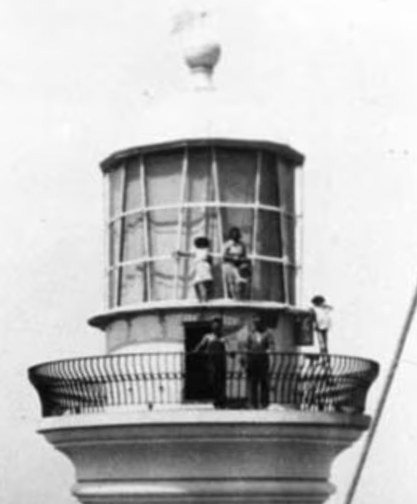
The original optical apparatus was a First Order Chance Brothers dioptric lens, floating on a mercury bath. This sophisticated piece of equipment weighed several tonnes and contained hundreds of hand-ground glass prisms arranged in a beehive pattern. The lens rotated on a bed of mercury, providing nearly frictionless movement.
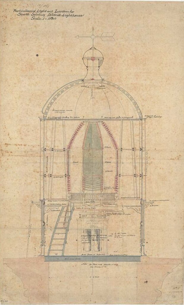

The light source evolved over time: 1880-1909: Oil wick burner 1909-1932: Kerosene vapor burner 1932-1975: Pressurized kerosene installation 1975-present: Electric lamp
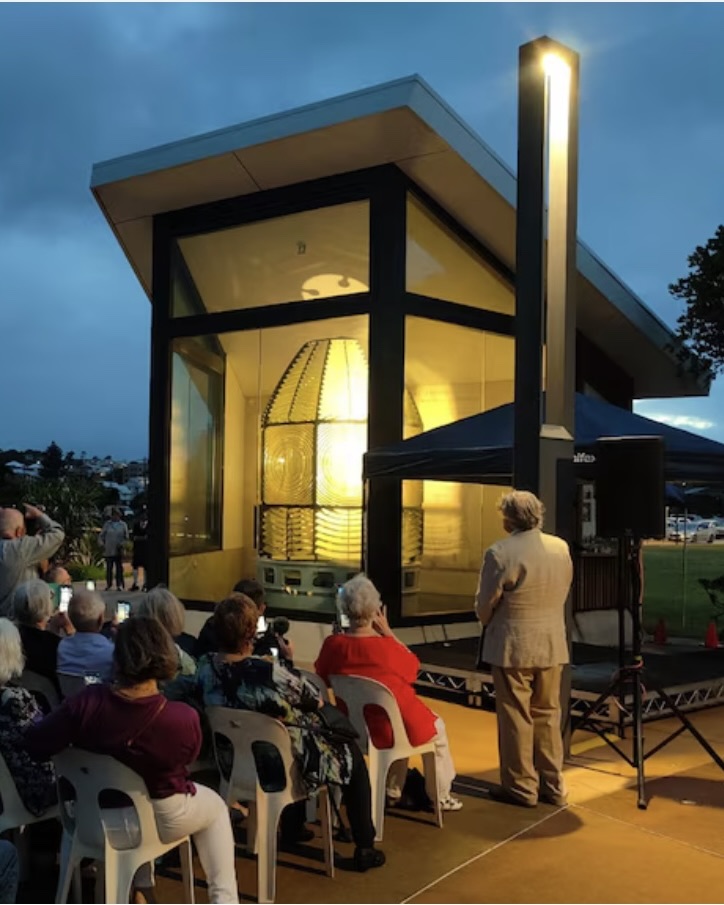
The original lens remains in service today, though with modern light sources. The mercury bath was sealed in the 1980s for safety reasons, but the original rotation mechanism continues to function.
Keepers of the Light:
Due to the island’s extreme isolation, three keepers and their families were stationed on the island, working a demanding roster. The complement typically included a Head Keeper and First and Second Assistant Keepers.
Notable keepers included:
Thomas Carlo (1880-1888) First head keeper, established many of the station’s operating procedures, known for his detailed weather observations and lost his wife to illness during his posting.
Edward Harrigan (1888-1902) Implemented significant improvements to the station’s gardens, kept detailed records of shipping movements and his daughter was the first child born on the island.
John Johnson (1902-1916) Known for his innovations in water conservation, established the station’s first radio communication system and lost two children to illness during his tenure.
William Bath (1916-1929) Served through World War I, improved the station’s signaling capabilities and established regular weather reporting procedures.
The last keeper, John Tait, departed on December 8, 1975, marking the end of an era in Australian lighthouse history. The lighthouse was automated in 1975, ending 95 years of resident keepers.


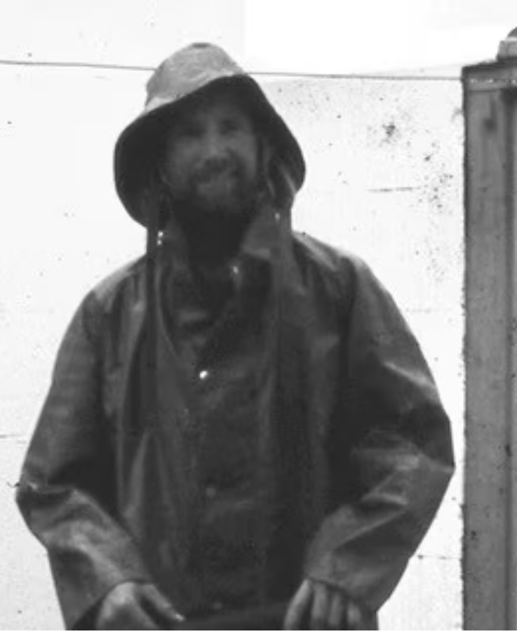
Life on the island was particularly challenging, keepers and their families had to be largely self-sufficient, maintaining vegetable gardens, poultry runs and goat herds for milk. In addition to their responsibilities for weather observation, station, signal station and basic medical facilities. Supply was unreliable and difficult
Children were educated via correspondence, with mothers often serving as teachers. The isolation meant that families had to be resourceful and self-reliant. Medical emergencies were especially problematic due to difficult access, leading to several tragedies over the years.
Shipwrecks & Tragedies:
The waters around South Solitary Island witnessed numerous maritime tragedies both before and after the lighthouse’s construction.
In the pre-Lighthouse era there were wrecks involving a number of unnamed vessels or unexplained disappearances in the 1850s and 1860s including the loss of the Mary Jane in 1857 with all hands and the Enterprise in 1867 which was wrecked on surrounding the reefs.
In the post-Lighthouse era the were also numerous incidents, the most significant of which was the SS Keilawarra (1886) which collided with the Helen Nicoll in rough seas, 40 lives were lost and the wreck lies in 75 meters of water which is now a protected marine archaeological site. In 1885 the City of Grafton struck rocks in heavy weather, no lives lost but the vessel was total loss. Then in 1891 the Marlborough was badly damaged when it hit a submerged reef but no lives were lost and the ship was successfully salvaged.
In more recent years a supply vessel was wrecked while making a routine delivery tom the island and there have been several fishing vessels lost in the vicinity and multiple rescue operations for recreational vessels and yachts, usually as a result of severe weather or navigational error and running into the many submerged rocks and reefs in the area.
There have also been a number of tragedies on the island including in 1907 when one of the keeper’s children died from appendicitis when rough seas prevented evacuation, in 1912 when an assistant keeper’s wife died after falling on rocks and in 1938 when a keeper seriously injured during maintenance work and had to wait three days for evacuation.

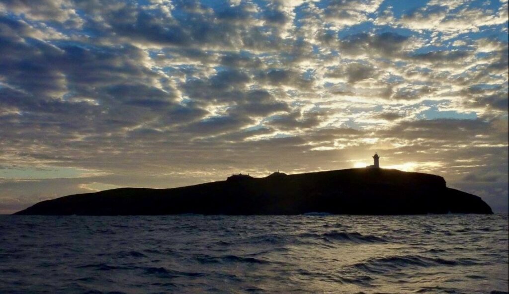
as seen from Woolgoolga back beach

Myths & Mysteries:
The island’s isolation and tragic history have led to numerous stories of supernatural occurrences and unexplained phenomena including keepers reporting unexplained footsteps in empty buildings, lights seen moving across the island when all residents were accounted for, strange sounds reported during calm weather, unexplained radio interference patterns and reports of a “phantom keeper” seen climbing the tower at night.
More recently there were a number of unexplained occurrences during WWII World War II Mysteries which included lights being seen when lighthouse was darkened, reports of suspicious vessels, unidentified radio transmissions and claims of submarine activity near the island.
Modern mysteries include electronic equipment malfunctions reported by maintenance crews, unusual weather patterns around the island, unexplained temperature variations in certain buildings and strange electromagnetic readings reported by researchers.
Interesting Facts:
South Solitary Island is one of the most isolated lighthouse stations ever built in Australia and has maintained its own weather station for over 90 years, it also operated its own post office until 1975, maintained its own school room for keeper’s children, was the site of early radio communication experiments and played crucial role in WWII coastal surveillance.
Due to its isolation the island has its own microclimate due to its isolation and is home to unique plant species adapted to the harsh conditions, it’s also surrounded by rich marine ecosystem and an important seabird breeding site. It’s part of the Solitary Islands Marine Park and has been the site for numerous scientific studies and there is a current proposal for establishing a marine research station on the island in conjunction with the existing National Marine Science Centre based in Coffs Harbour.
Current Status:
South Solitary Island lighthouse remains an active aid to navigation under the control of the Australian Maritime Safety Authority. It is part of the Solitary Islands Marine Park, a protected seabird nesting site and a marine exclusion zone. There are plans to establish a marine research station on the island in the future subject to passing an environmental impact study. Special permits are required for visits and its isolation and difficult access have helped preserve much of its original character, making it one of the most complete examples of a 19th-century lighthouse station in Australia.
Leave a Reply


")
I’ve not heard of this one Mike. Quite an interesting spot and I look forward to reading about your visit there in the new year. Btw. Happy NeW YeAr, I hope 2025 flows into more great finds on your journey.
Quite a spot Mike and I look forward to your boots on the ground visit there early in the New Year. Speaking of, Happy NeW YeAr, I hope 2025 is a cracker!
Quite a spot Mike and I look forward to your boots on the ground visit there early in the New Year. Speaking of, Happy NeW YeAr, I hope 2025 is a cracker!
PS. Having some issues filling in the Name, Email and Website fields here using Safari on Mac. My typed text is white and the text field has a white background also.