
Location:
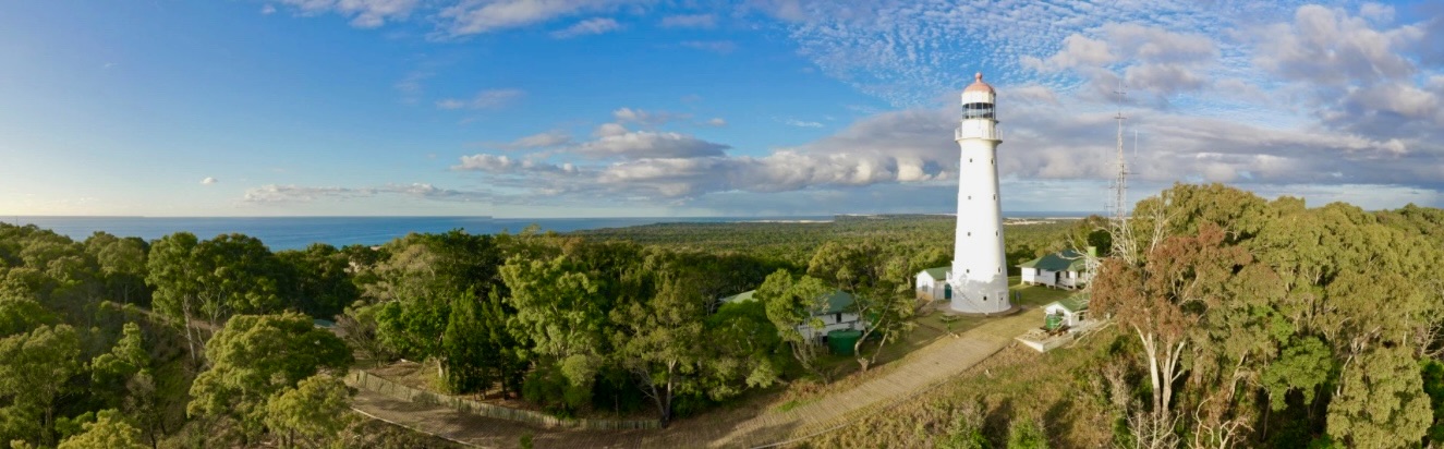
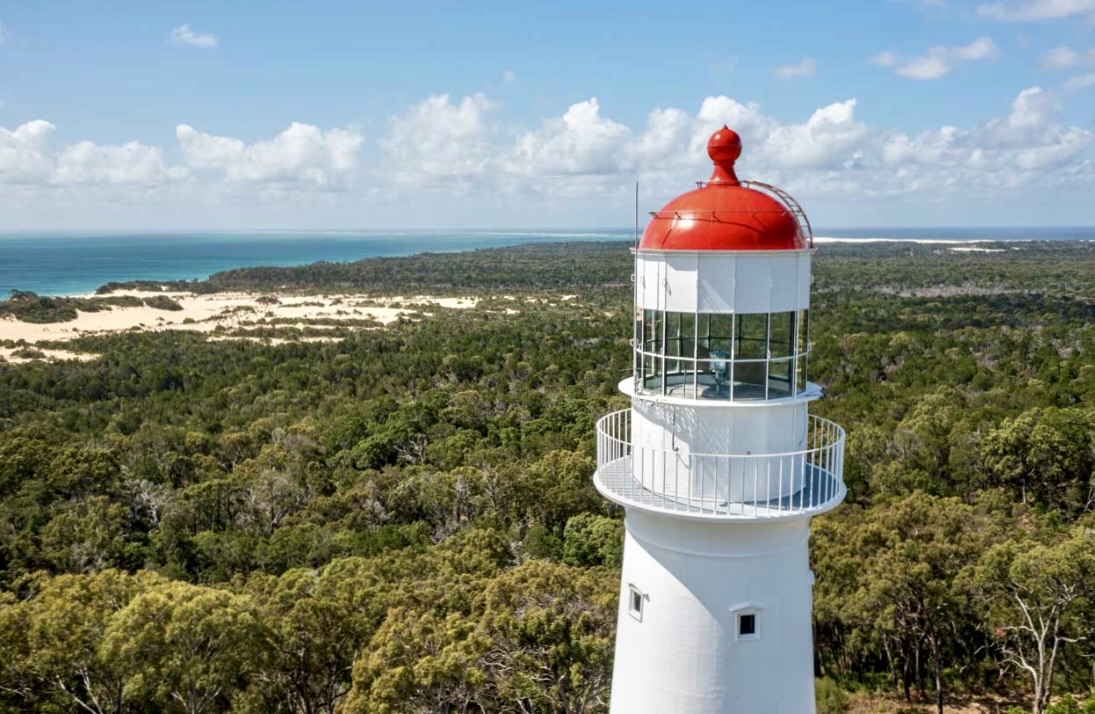
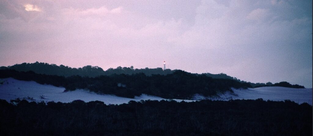
Sandy Cape Lighthouse stands at the northernmost point of K’gari (Fraser Island), Queensland, approximately 360 kms north of Brisbane. The lighthouse is positioned 100 meters above sea level on one of the highest points of the sand dunes that characterise the region. Sandy Cape is the tallest and second oldest lighthouse in Queensland. This strategic location allows the light to be visible far out to sea, marking the northern approach to Hervey Bay and the southern entrance to the Great Barrier Reef.
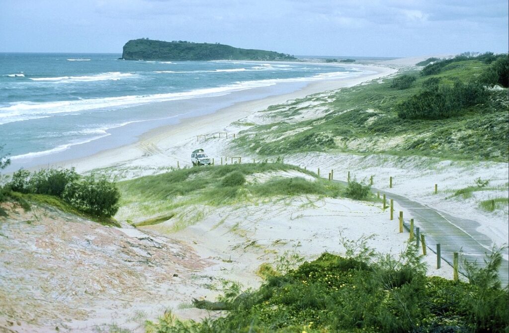
The site experiences severe weather conditions typical of its exposed maritime location, including tropical cyclones, strong prevailing southeasterly winds, and intense summer storms. The unique challenge of maintaining a lighthouse on a foundation of sand required innovative engineering solutions during both construction and ongoing operations.
GPS: Lat: 24° 43’ S : Long: 153° 12’ E
First Exhibited: 1870 (Automated June 1991, Destaffed June 1994)
Tower height: 85′ (26m). Focal height: 421′ (128 m) msl
Original Lens: 1st Order Chance Bros. (Current lens VRB-25)
Intensity: 160,000 candela
Range: 21 nml (39 km)
Characteristic: One white flash every ten seconds: [Fl W 10s]


Indigenous History:
The Butchulla people are the Traditional Owners of K’gari (Fraser Island), including Sandy Cape. They know this area as “Guwara,” meaning “deep water.” Archaeological evidence reveals continuous occupation spanning thousands of years, with significant middens and cultural sites throughout the region.
The area held particular significance for the Butchulla people due to its elevation and strategic position, serving as an important lookout point for monitoring weather patterns, marine life movements, and seasonal changes. The surrounding waters were rich fishing grounds, and the high dunes provided excellent vantage points for spotting schools of fish and migrating whales.
Traditional knowledge systems developed by the Butchulla people included sophisticated understanding of the complex dune systems, seasonal weather patterns, and marine resources. Their stories speak of the cape’s significance in ceremonial practices and its role in maintaining connections between coastal and inland groups.
Today, the Butchulla people maintain strong cultural connections to Sandy Cape through involvement in cultural heritage management and interpretation programs.


Colonial History:
European maritime engagement with Sandy Cape began with Lieutenant James Cook, who named it during his 1770 voyage, noting the prominent white sand dunes that characterised the area. The cape gained increased significance following:
- The discovery of the Mary River in 1847
- The establishment of Maryborough as a port in 1848
- Growing coastal trade along the Inner Route to Torres Strait
- Increasing shipwrecks in the dangerous waters around Breaksea Spit
The decision to build a lighthouse at Sandy Cape was driven by the urgent need to protect shipping entering the Great Barrier Reef passage. Colonial Marine Surveyor Commander George Poynter Heath specifically identified this location as crucial for safe navigation of the surrounding treacherous waters.
The Lighthouse:
In 1864 two committees appointed by the newly independent Queensland government to deal with the issue of coastal lighthouses tabled their reports and the only location for which both committees were in clear agreement about the need of a lighthouse was Sandy Cape. The site was also strongly recommended by Joseph Brady, Queensland Engineer for Harbours and Rivers of the time, on a tour of inspection he did in 1865. This recommendation was influenced by the fact that over twenty vessels had been lost on Breaksea Spit, off the northern tip of K’gari, even Cook’s Endeavour nearly floundered there.
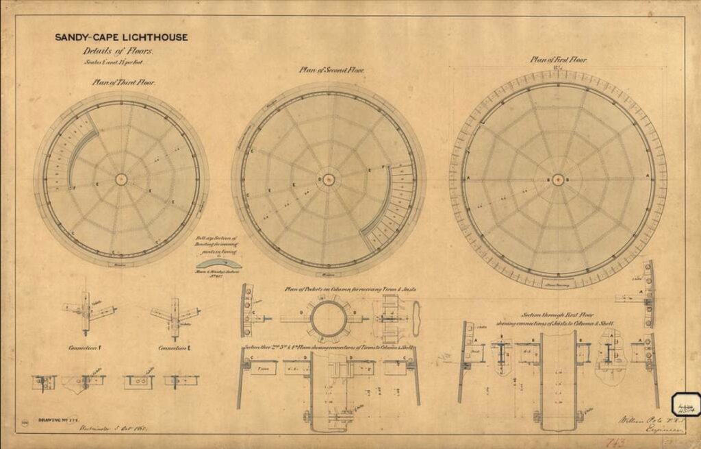
As a result an order for the prefabricated tower was placed with Kitson & Co. of Leeds, England, the design being done by William Pole who was head architect for Hennet Spinks & Co of Bridgewater, a UK company that specialised in the design of prefabricated cast iron lighthouses. The lantern and apparatus were ordered from Chance Brothers of Birmingham, England, and by 1867 all the materials had arrived in Brisbane, however due to the financial situation the contract for construction was not awarded until 1870. The winning tender for the construction of the tower was of £4,524 by the brothers John and Jacob Rooney of Maryborough, Sandy Cape Light being the first of several lighthouses they constructed, followed by lighthouses at Cape Bowling Green, Cowan Cowan Point, Cape Capricorn, Lady Elliot Island and Booby Island.


The materials from Brisbane and cement from Sydney were brought by ship, then unloaded into workboats (barges), then to trolleys (whims) and hauled by horse, on a specially constructed two stage trolley way laid with wooden rails, to the site, 100 m above sea-level. The first stage rose 50 metres over a 1.2 km section, and the final 50 metre lift to the site was by a horse operated windlass, with the trolleys pulled up the 60 degree sandy slope. The trolley way was maintained up until approx 1927.

It was originally planned that the light will be the first to be constructed by the new Queensland government. However, due to a financial circumstances Sandy Cape missed out on this honour and was beaten by the lower cost Bustard Head Light, constructed in 1868. Sandy Cape light was finally officially lit in May 1870. Upon completion Captain George Poynter Heath, the first Portmaster of Queensland, stated that the greatest danger on the Queensland coast, the Breaksea Spit was now safe.
The Buildings:
The tower is similar to the one already constructed at Troubridge Shoal, South Australia, being assembled from cast iron segments manufactured by the Hennett Spinks and Company of Bridgewater, in Somerset, England.
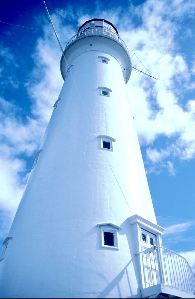
The lighthouse is round conical in form, standing 26 m high. It is constructed of prefabricated cast iron plates, and painted white, with splayed flanges at the base standing on a 4 m concrete base foundation. The diameter at the base is approximately 7 m tapering to about 4 m at the top, below the lantern. Internally it has five floors,connected by a spiral iron staircase with cast iron steps, adjoined to the internal walls. The lighthouse has two entrances, one at the bottom and one about 3 m above the ground, accessible by an outside staircase supported on brackets. The bottom entrance provides access to the ground floor, where a display of various maritime artefacts resides, including the 4th order Chance Brothers lens. The top entrance leads to the main tower. The words “”Kitson & Co LEEDS 1866” are cast above the doorway.
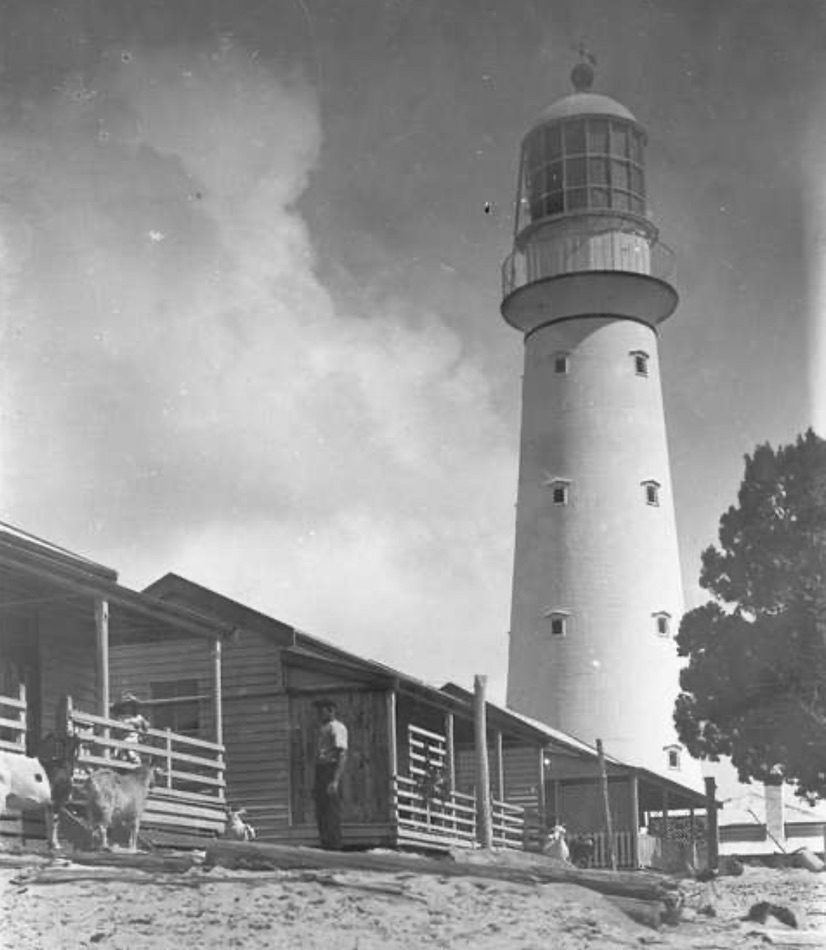

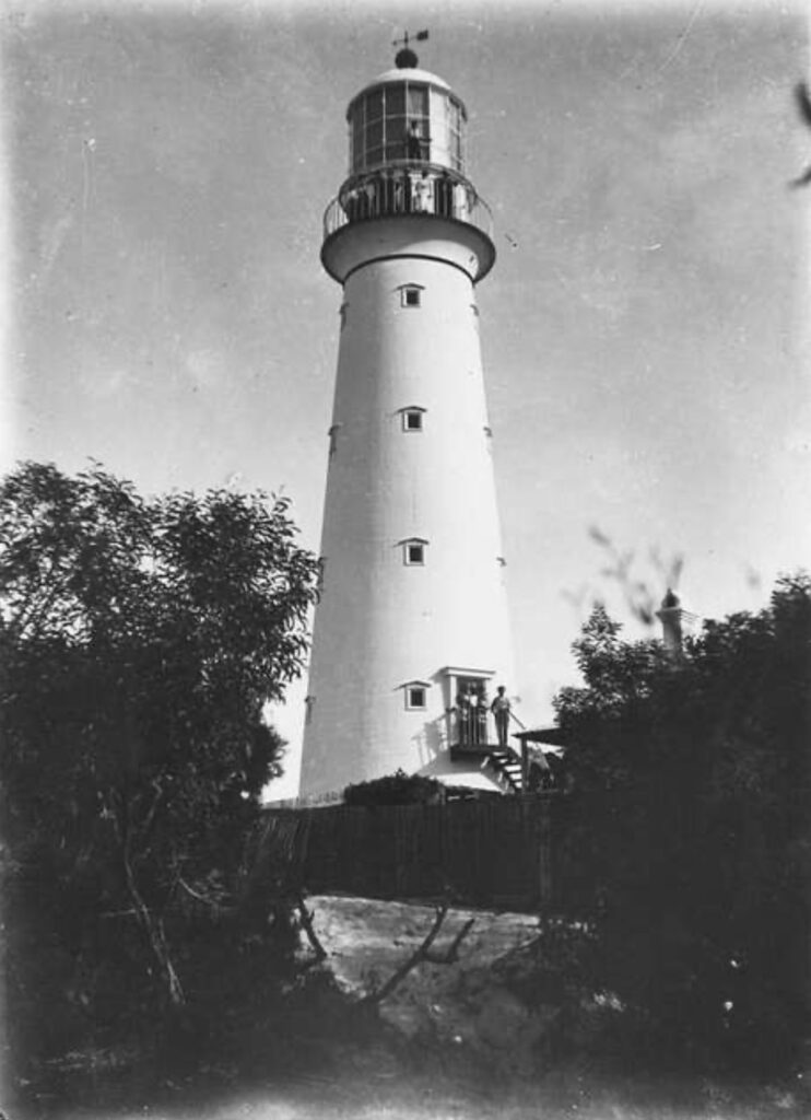
The tower is topped by a cantilevered iron balcony with a simple iron balustrade. On top of the balcony is the lantern room, with a cast iron catwalk supported on ornate iron brackets. The lantern room is constructed of cast iron, topped by a domed roof clad with copper sheeting and painted bright red.
In addition to thev tower there are two lighthouse keeper’s cottages flanking the lighthouse, one for the head keeper and one for the assistant keeper. The keeper’s quarters were designed to withstand severe tropical weather while providing comfortable living conditions for isolated families. Wide verandas, high ceilings, and sophisticated ventilation systems demonstrated adaptation to the tropical environment. group of service buildings, including a workshop, powerhouse, garage and bulk fuel store are located adjacent to the lighthouse.
During World War II the station was also RAAF No. 25 Radar Station. 30 men were based her in huts in the valley. The bunkers still remain today as visitor attraction. During this period the keepers and their families still remained at the station.
Also on the premises is a small picket fenced cemetery to the south of the station, with several stone headstones.
Technical Details:
The original apparatus was a revolving First Order Chance Brothers apparatus which showed a light characteristic of one white flash every two minutes, visible for 20 nautical miles (37 km) so as to extend over the Breaksea Spit. The light source was an Argand lamp fueled by Colza oil or Rapeseed oil. Rotation was achieved by a clockwork mechanism that had to be wound regularly. Also built in the station were quarters for the head keeper and three assistant keepers, and their families, built of timber framed weatherboard with corrugated iron roofs.
In 1875, the light source was changed to kerosene. In 1915, the station was transferred from Queensland to the Commonwealth government. The light was upgraded in 1917 and again in 1923. In one of these upgrades when the light source was converted to an incandescent mantle using vaporised kerosene.
In the 1930’s the lens was replaced with a 4th order Chance Brothers lens and the lighthouse was converted to electrical operation. Around that time the keepers’ cottages were rebuilt and most of the other buildings at the premises were constructed. A boarded roadway was constructed in the 1970s and a brick engine room was built in 1974.

In 1995, the lighthouse was converted to solar power and automated, and the 4th order lens was replaced with a VRB-25 apparatus. In 1997 the station was finally demanned, and was transferred back to the Queensland Government who employ two rangers to manage the site, their two quarters and workshop have been powered by solar and wind RAPS (Remote Area Power Supply) since 2001, with storage in a battery bank and backup by diesel generator. Installation and manufacturers problems with the wind turbine has seen the station using only solar and diesel since October 2002.
Keepers of the Light:
The isolation and challenging conditions at Sandy Cape created a unique community of lighthouse keepers and their families who demonstrated exceptional resilience and dedication.


James Rooksby (1870-1885), the inaugural keeper, established the foundational practices for operating this remote station. His detailed journals provide invaluable insights into early life at Sandy Cape, including innovative solutions for maintaining equipment in the harsh sandy environment. His wife Catherine became known for her extensive botanical collection, documenting the unique flora of the sand dune environment.
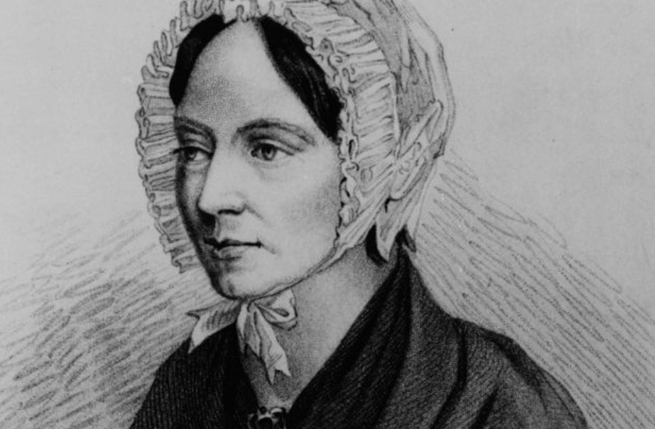
As with many remote major Queensland lights a school mistress was supplied and would have been billeted with one of the families. Sandy Cape had a much loved and famous school teacher – Selina Lovell, who served from 1882 until 1898, and who described and named a number of new plants, and recorded two unknown “sea monsters” one which seems to fit the description of a Manta Ray, the other…somewhat unbelievably, a Plesiosaur!
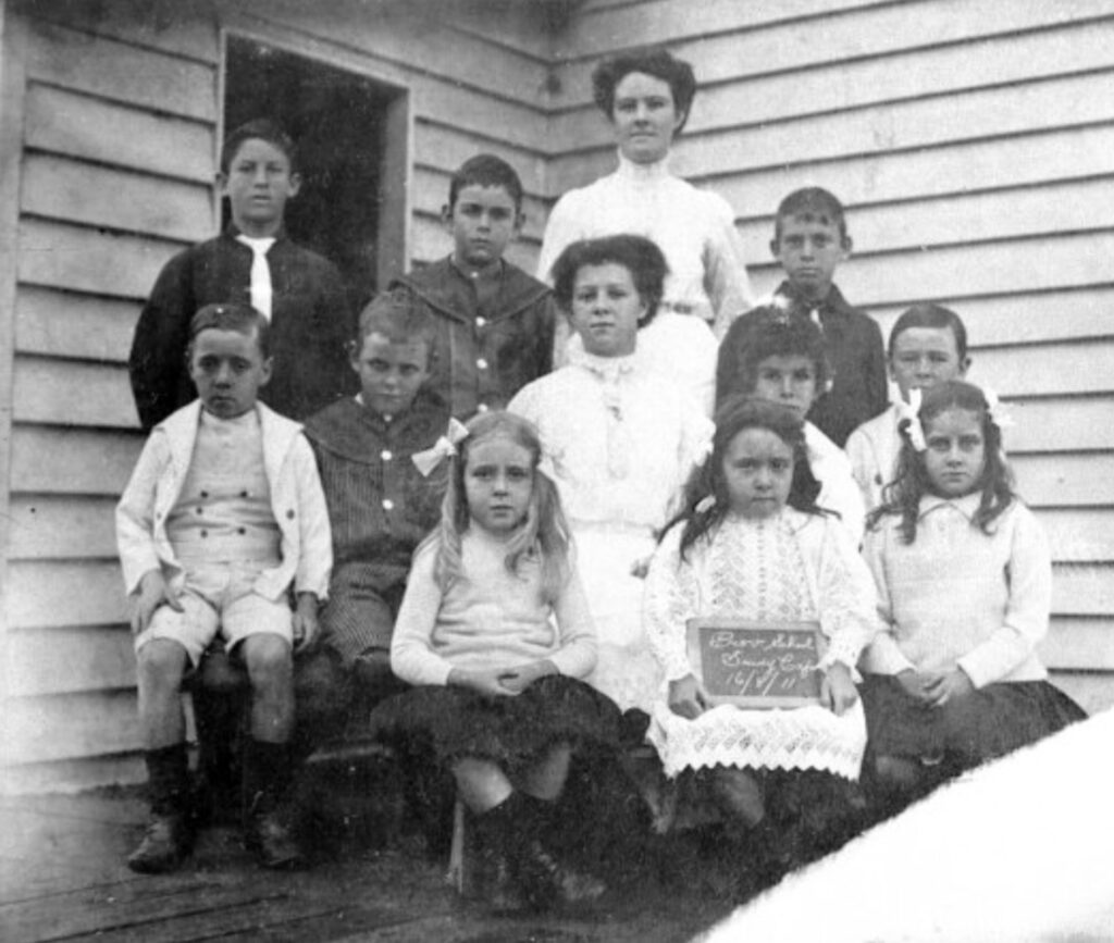
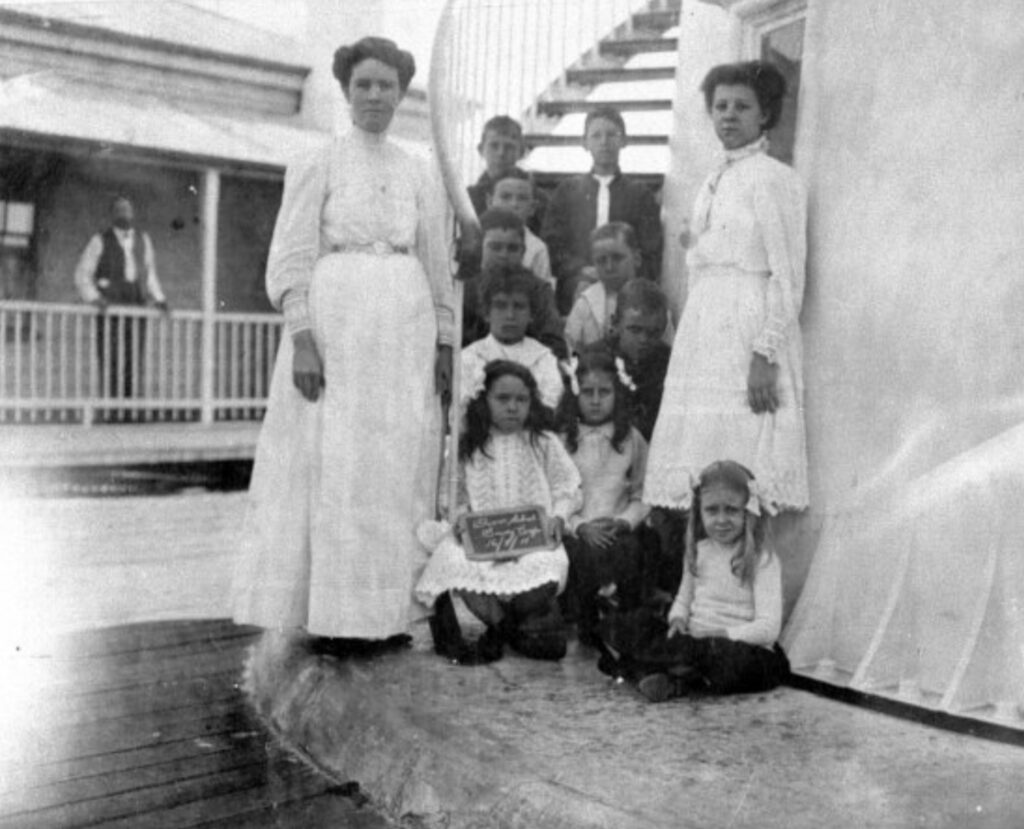
Selina Lovell pictured with her class on 16.8.1911
George Byrne (1885-1904) revolutionised the station’s operations through systematic improvements to water management and dune stabilization. His engineering background proved crucial in developing methods to protect the lighthouse foundations from sand erosion. The “Byrne System” of dune vegetation management was later adopted at other coastal lighthouses.
During World War II, Keeper Frederick Marsh (1939-1952) played a crucial role in coastal surveillance. His logs detail numerous sightings of submarine activity and coordination with defence forces. The station became an important strategic observation point, with additional military personnel stationed on site.
The Mitchell family (1952-1973) holds the record for the longest continuous service at Sandy Cape. John Mitchell, his wife Eleanor, and their children embodied the self-sufficient lighthouse community, maintaining extensive gardens and developing innovative solutions to the challenges of isolated living. Eleanor’s detailed accounts of daily life provide valuable historical documentation of lighthouse family experiences.

Shipwrecks & Tragedies:
The waters surrounding Sandy Cape and Breaksea Spit have long been feared by mariners, earning their place among Queensland’s most treacherous maritime zones. The combination of shifting sandbanks, powerful currents, and treacherous weather has claimed numerous vessels over the centuries, writing a dark chapter in Australia’s maritime history.
The most notorious early disaster was the loss of the Sterling Castle in 1836. The vessel, captained by James Fraser, struck a reef near Sandy Cape during a journey from Sydney to Singapore. The survivors, including Captain Fraser’s wife Eliza, made it to shore but faced a harrowing ordeal. Captain Fraser would not survive the experience, but Eliza Fraser’s remarkable tale of survival among the Indigenous people of the region would become one of colonial Australia’s most famous narratives, though one that requires careful interpretation given the cultural and historical context of the time.

Twenty years later, the waters claimed an even heavier toll with the loss of the Woodlark in 1856. The vessel, carrying 37 souls, encountered severe weather near Breaksea Spit. No survivors were ever found, and for weeks afterward, debris and personal effects would wash ashore along the coastline, silent testimonies to the disaster. The loss of the Woodlark served as a tragic reminder of the area’s dangers and added urgency to calls for a lighthouse at Sandy Cape.
The Sandy Cape Lighthouse was finally established in 1870, but while its presence helped prevent some disasters, the waters continued to claim vessels. The most significant early lighthouse-era loss was the SS Marloo in 1914. During a fierce cyclone, the steam vessel found itself caught in deteriorating conditions. Despite the lighthouse’s warning beacon, the Marloo ran aground on Breaksea Spit. Through heroic efforts, all passengers and crew were saved, but the vessel herself was a total loss.
Another famous incident occurred on the 7th of July 1935 when the SS Maheno was blown ashore of 75 Mile Beach on the eastern side of Fraser Island, all passengers and the crew were able to escape and camped on the beach until rescued on 10th July. After a number of unsuccessful attempts to refloat the ship it was declared a total loss and the wreck has become a major tourist attraction.
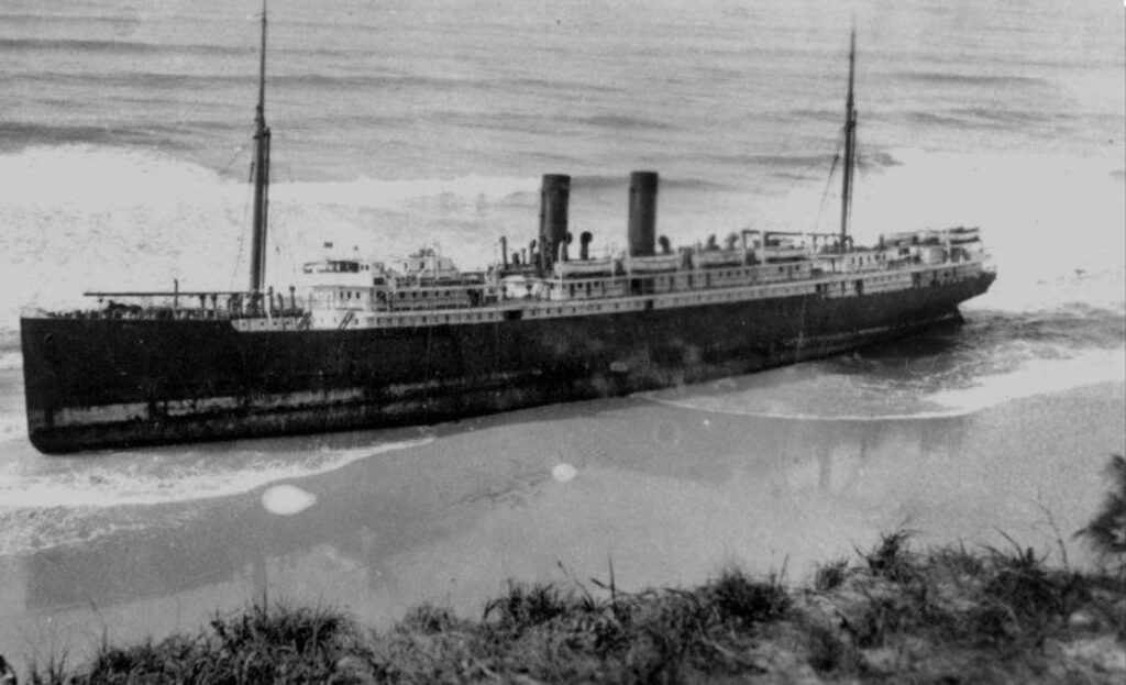
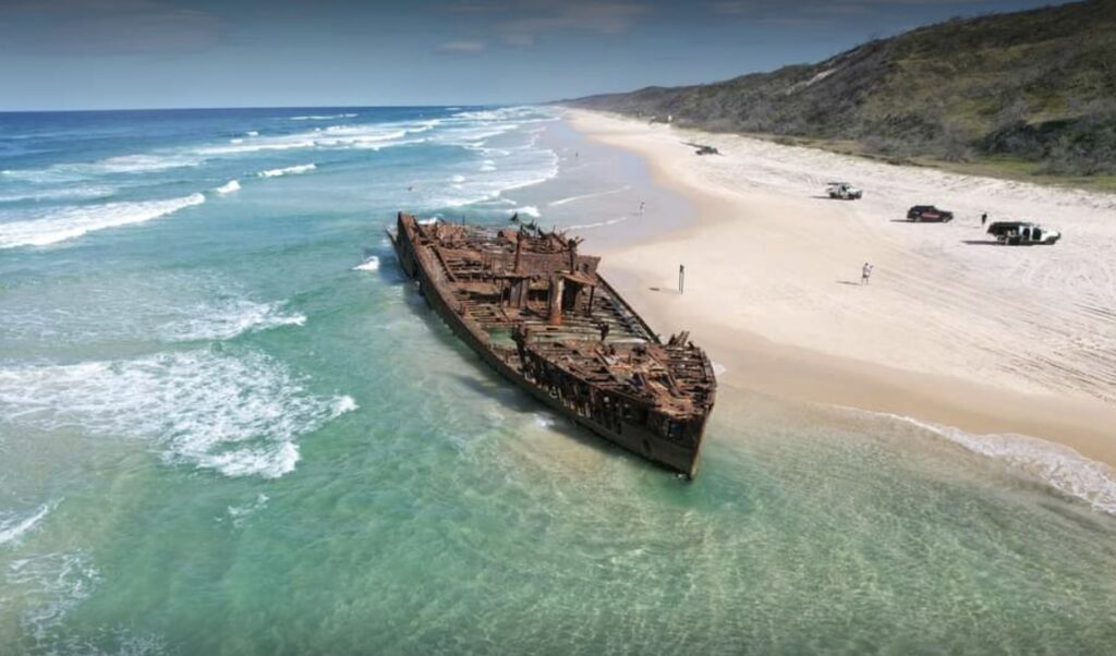
the remains of the SS Marloo on 75 Mile Beach, K’gari
World War II brought new dangers to these waters. In 1942, the Kramboota, a coastal freighter, was making her way north when she was spotted by a Japanese submarine. In the early hours of the morning, torpedoes struck the vessel, sending her to the bottom with several crew members. The incident highlighted how even familiar waters could harbor new threats during wartime.
The post-war period saw continued incidents, though improved navigation and safety measures had reduced their frequency. The loss of the Angelyn in 1965 demonstrated that even modern vessels could fall victim to these waters. The vessel experienced catastrophic structural failure during heavy seas near Sandy Cape, a reminder that the combination of powerful weather and treacherous waters could overcome even twentieth-century engineering.
Beyond these major disasters, numerous smaller vessels have met their end in these waters. Local fishing boats, pleasure craft, and smaller trading vessels have all fallen victim to the area’s challenges. Each incident added to the region’s reputation and contributed to the ongoing evolution of maritime safety measures.
Myths & Mysteries:
Like many remote lighthouses, Sandy Cape has accumulated a rich folklore of unexplained phenomena over its 150+ year history. The isolation, extreme weather conditions, and dramatic landscape have contributed to numerous mysterious tales.
The Ghost Ship: Multiple keepers recorded sightings of a phantom vessel that appears during strong northeasterly winds. First documented by Keeper Rooksby in 1873, the apparition is described as a square-rigged ship with torn sails, appearing in the breakers off Breaksea Spit before vanishing. Some associate these sightings with the unconfirmed loss of an unknown vessel in the 1850s.
The Dune Walker: Lighthouse families reported encounters with what became known as “The Dune Walker” – a figure seen traversing the massive sand dunes during sunset, particularly before major storms. The Mitchell children’s diaries (1952-1973) contain detailed descriptions of these sightings, noting that the figure never left footprints in the sand.
Signal Light Mystery: During the 1930s, multiple keepers documented unexplained light signals from the ocean, occurring in patterns that didn’t match any known vessel’s navigation lights or distress signals. Keeper Marshall’s detailed records suggest these lights followed specific patterns corresponding to major astronomical events.
The Singing Tower: A unique acoustic phenomenon occurs during certain wind conditions, producing what witnesses describe as a musical tone emanating from the lighthouse tower. While likely explained by wind interactions with the tower’s architecture, the precise mechanism remains unclear, particularly given the sound’s reported correlation with significant maritime events.
Butchulla Perspectives: Traditional owners maintain that many of these phenomena relate to the area’s role as a spiritual boundary point. Their cultural knowledge suggests Sandy Cape marks a transition zone between physical and spiritual realms, particularly during specific seasonal alignments.
Current Status:
Sandy Cape Lighthouse remains an active aid to navigation, now operated remotely by the Australian Maritime Safety Authority (AMSA). The site was automated in 1997 and underwent significant modernization while preserving its historical integrity. The lighthouse was heritage-listed in 1987, recognizing its exceptional historical and technological significance.
The site is managed by Queensland Parks & Wildlife Service as part of the K’gari (Fraser Island) World Heritage Area, with access restricted to protect both the sensitive equipment and the cultural heritage values. The Butchulla Aboriginal Corporation plays an active role in site management and cultural heritage interpretation.
Despite automation, Sandy Cape Lighthouse continues its vital role in maritime safety while standing as a testament to Queensland’s maritime heritage and engineering achievement. The site remains a significant landmark for both its practical function and its historical importance in Queensland’s maritime history.

from the western shore to the east.
A Personal Note:
With due respect to the other lighthouses I’d visited I was looking forward to visiting Sandy Cape with great anticipation. Not only for fact it would be my first First Order lighthouse, but equally for the challenge of getting to it which involved taking Max on the car ferry from crossing K’gari, then driving up the beach on the eastern side of the island to reach the northern tip, then a 5 km hike over the sand dunes to reach the lighthouse and returning to the southern tip to catch the ferry to Inskip Point, a round trip of 250kms on sand, crossing numerous creeks and rounding various headlands. However, the best laid plans don’t always work out and when I got to the ferry at River Heads I learnt that the Ngkala Rocks crossing point was impassable and due to recent rains there were there were a number of “washouts” along the beach. The only option was an inland route which was not recommended for anyone other than extreme 4X4 drivers! Remembering that I still had about 40,000kms to travel in Max I decided it wasn’t worth the risk and luckily for me I had an option to do it by plane! My new good friend Lloyd Cahill, who I was staying with on the Sunshine Coast had offered to fly me out to the lighthouse in his plane. This proved to be a classic case of turning a problem into an opportunity, and while I was disappointed not to be doing it the hard way the plane trip was amazing and I’m sure Max appreciated not being tortured!


Leave a Reply


")