
The waters of Port Phillip Bay cover an area of 1,900 square kilometers and have one of Australia’s most comprehensive lighthouse networks. This network of lights, bells and buoys extending from the treacherous entrance at The Rip to the shifting sandbars and navigable channels leading to the commercial ports of Melbourne, Williamtown and Geelong tells the story of colonial development, technological evolution and the on going contest struggle between mariners and the unpredictable and ever changing sea.
This extensive network encompasses the dramatic coastal stations guarding the bay’s entrance, the precision leading lights marking shipping channels, and the innovative pile lights warning of underwater hazards, each representing different eras of maritime technology and reflecting the bay’s transformation from colonial gateway to modern shipping hub.
Point Lonsdale Lighthouse:
As detailed in the companion Point Lonsdale report (# 70), the Point Lonsdale lighthouse has stood watch over the western approach to The Rip, the narrow entrance to Port Phillip Bay. The Rip is one of the most notorious entrances to any bay in the world. The current lighthouse, built in 1902, represents the culmination of over half a century of navigational evolution at this critical location.
The Queenscliff Lighthouses:
As detailed in the companion Queenscliff report, the Black Lighthouse (High Light) and White Lighthouse (Low Light) form the essential leading light system that guides vessels through The Rip’s precise safe channel. These 1862-1863 structures represent the urgent colonial response to the mounting toll of shipwrecks that threatened Melbourne’s maritime lifeline.
Port Melbourne Leading Lights:
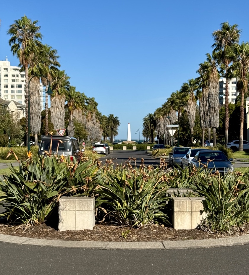
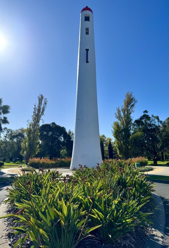
The Port Melbourne Leading Lights, built in 1924, marked a new era in harbor navigation—the transition from coastal guidance to precise industrial channel management. The Port Melbourne Lighthouses were built in 1924, and in conjunction guided ships by marking the centre of the Port Melbourne Channel from Port Phillip Bay.
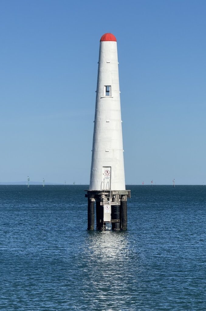
The Rear Light:
The rear light rises as a 26-meter concrete tower, positioned 500 meters inland from its companion front light. This substantial structure featured not just the main red occulting light flashing every six seconds, but also a sophisticated directional system—a 24-hour directional light with green, white, and red sectors, each covering only fractions of degrees to mark the precise channel center within an arc of just 1.5 degrees.
This precision navigation system represented a significant evolution from the broader-beam lights of earlier generations, reflecting the increasingly professional approach to maritime navigation in the interwar period when steam-powered cargo vessels and passenger liners demanded more exacting standards than the sailing ships of the colonial era.
The Front Light:
The front light presents a more humble appearance—a round, tapered wooden-framed structure built on piles, originally connected to shore by a narrow wooden footbridge that has since been removed. The front light originally showed a fixed green light over a 26-degree sector, while a second green light occulted every six seconds within the critical four-degree sector marking the channel’s center.
The Channel Markers:
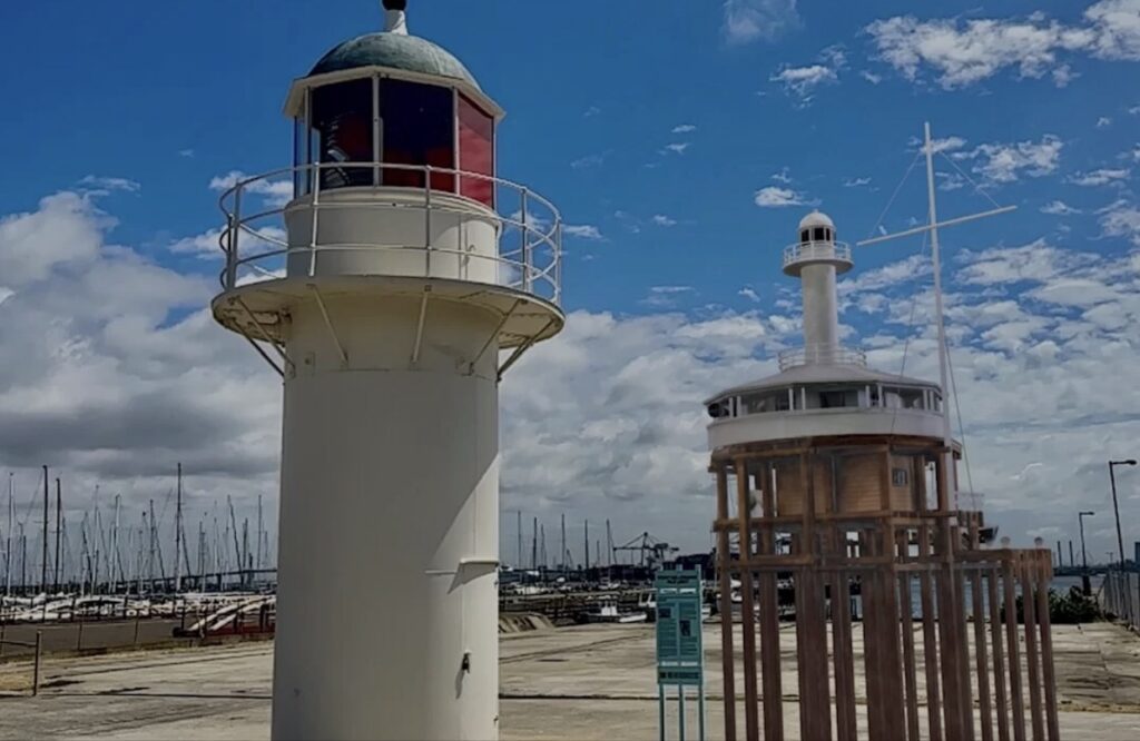
West Channel Pile Light:
The West Channel Pile Light is an active two-storey octagonal lighthouse in Port Phillip, Victoria, Australia. It was built in 1881, replacing a lightship installed in 1854, to mark the north-east end of the West Sand. This transition from floating to fixed navigational aids reflects the increasing sophistication of harbor management as shipping traffic intensified.
The West Channel Pile Light represents the engineering solution to marking underwater hazards where traditional lighthouse construction was impossible. Built on piles driven into the seabed, these structures required innovative construction techniques and ongoing maintenance in the harsh marine environment.
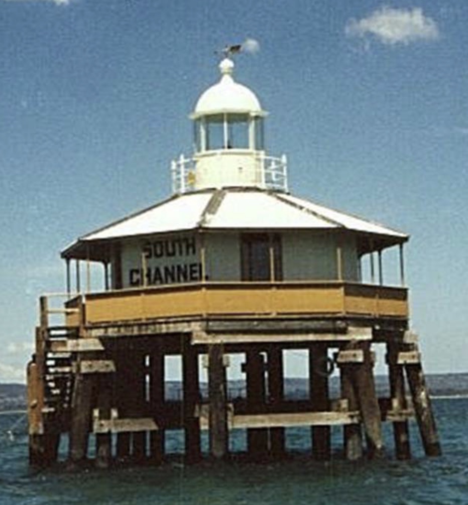
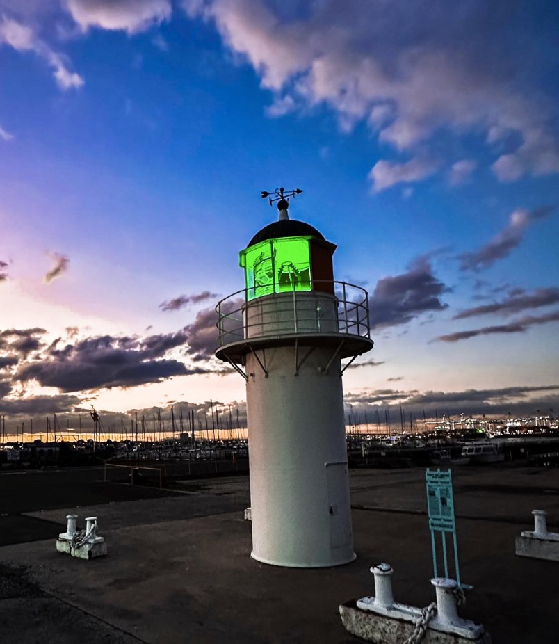
South Channel Pile Light:
After 125 years, the South Channel Pile Light has been restored and relocated to a safer location to assure its preservation as a piece of our maritime history. This remnant of 19th century channel markers that lead Melbourne bound ships through the South Channel was established in 1874. It was the front light, with the Eastern Light at McCrae the rear light.
The South Channel system demonstrates the comprehensive approach to harbor navigation that characterized Victorian maritime infrastructure development. By pairing the pile light with the substantial Eastern Light at McCrae, authorities created a leading light system that could guide vessels through the challenging South Channel approach to Melbourne.
Point Gellibrand Pile Light:
The Gellibrand Pile Light marked a dangerous reef off Point Gellibrand at Williamstown for 70 years, representing an innovative solution to a persistent navigation problem in Port Phillip Bay, Victoria.
The reef was initially marked by a series of lightships beginning in 1856, starting with the former barque New Constitution. A second lightship operated from 1861 to 1895, followed by a circular iron vessel from 1895 to 1906. The lightship arrangement proved problematic as vessels regularly broke their moorings.
The Port and Harbour Board ingeniously recycled the existing lightship by placing it atop a newly constructed pile structure. The new Gellibrand Pile Light commenced operation on August 1, 1906. Construction involved driving 33 piles up to 70 feet long through clay to reach the basalt shelf in 32 feet of water. After initial stability issues, 3,000 tons of bluestone blocks were placed around the base two months later.
The light was modernized in 1938 with electrical operation via a submarine cable from Breakwater Pier, replacing the original oil-powered system. It featured a powerful fog horn audible for six miles. The structure was continuously manned throughout its operational life.
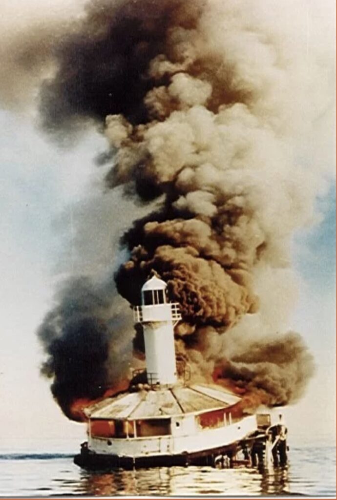
On June 21, 1976, during foggy conditions with the fog horn inoperative, the 7,000-tonne cargo ship Melbourne Trader struck the pile light. The collision severed the piles at water level, leaving the structure hanging precariously. Deemed too dangerous to repair, authorities ordered the structure burned on June 23, 1976. The lantern and dome were salvaged and are now displayed at Seaworks Maritime Precinct in Williamstown.
The Rosebud Lighthouse:
Sometimes known as either the Dromana or McCrae Lighthouse, this lighthouse is actually located between both areas at McCrae. It is also known as the South Channel Lighthouse. Measuring 33.5 metres in height it is Victoria’s tallest lighthouse.
It was constructed in England during 1874 and was erected on its current site in 1883. The Eastern Lighthouse was used to guide ships travelling through Port Phillip towards Melbourne. This lighthouse represents the imperial approach to colonial infrastructure—manufactured in Britain’s industrial centers and shipped to Australia as part of the comprehensive maritime safety network.
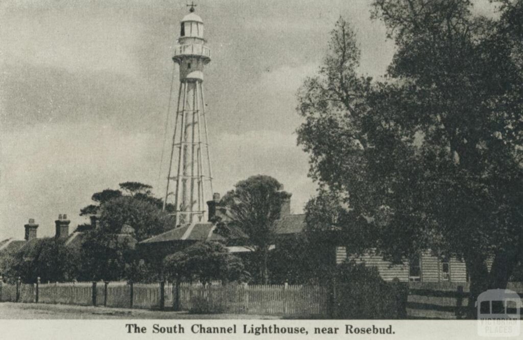
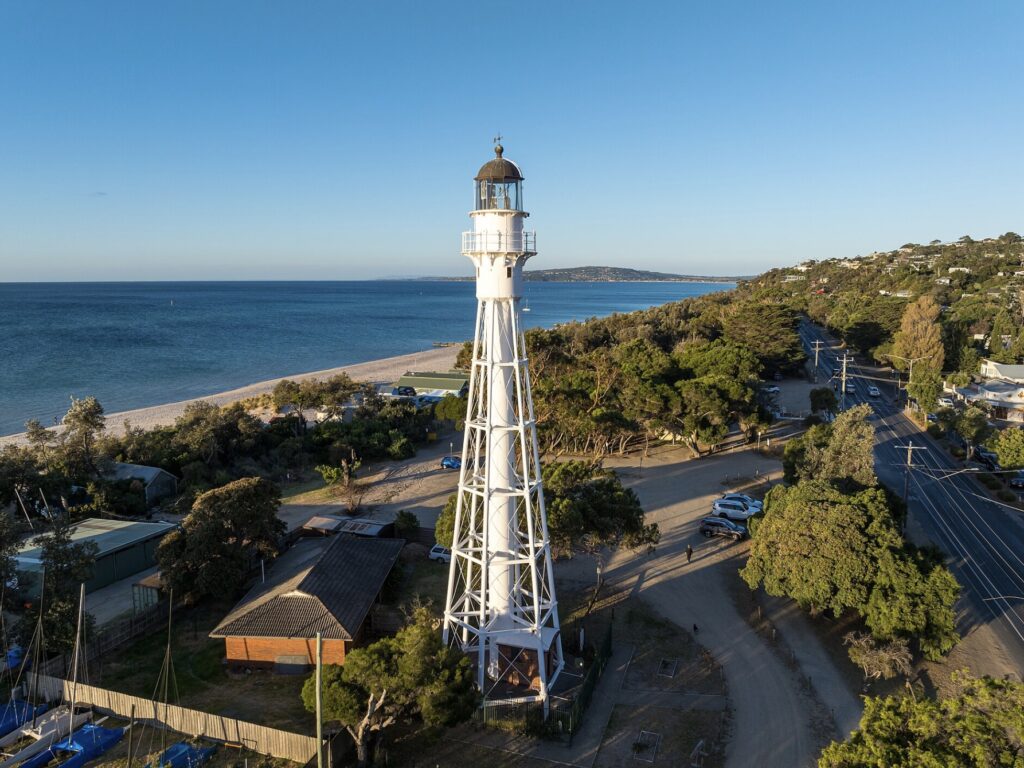
The McCrae lighthouse served as the rear light for the South Channel leading light system, partnering with the South Channel Pile Light to create a precise navigation system for vessels approaching Melbourne from the east. The lighthouse keepers quarters were demolished during the late 1940s and the actual lighthouse was decommissioned, reflecting the transition to automated systems that characterized mid-20th century lighthouse operation.
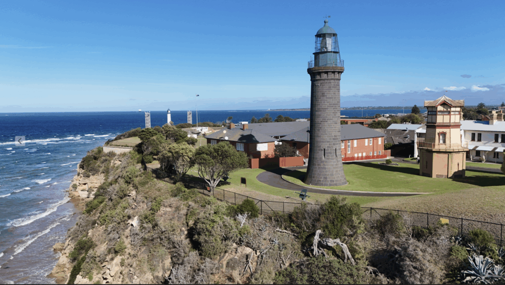
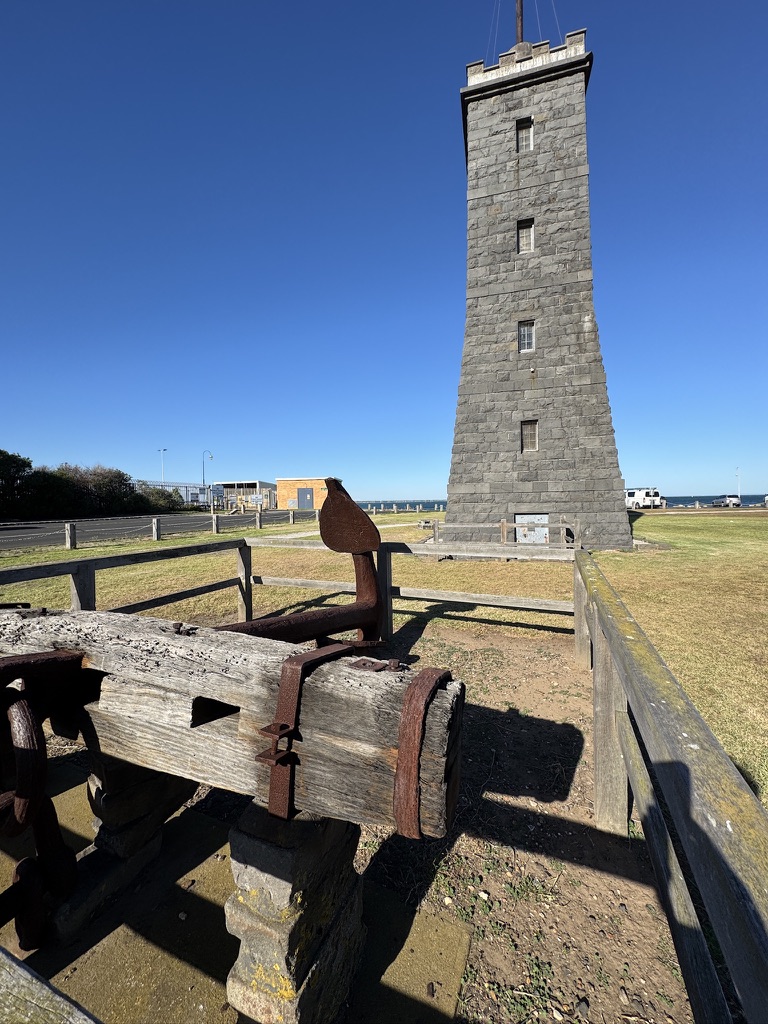
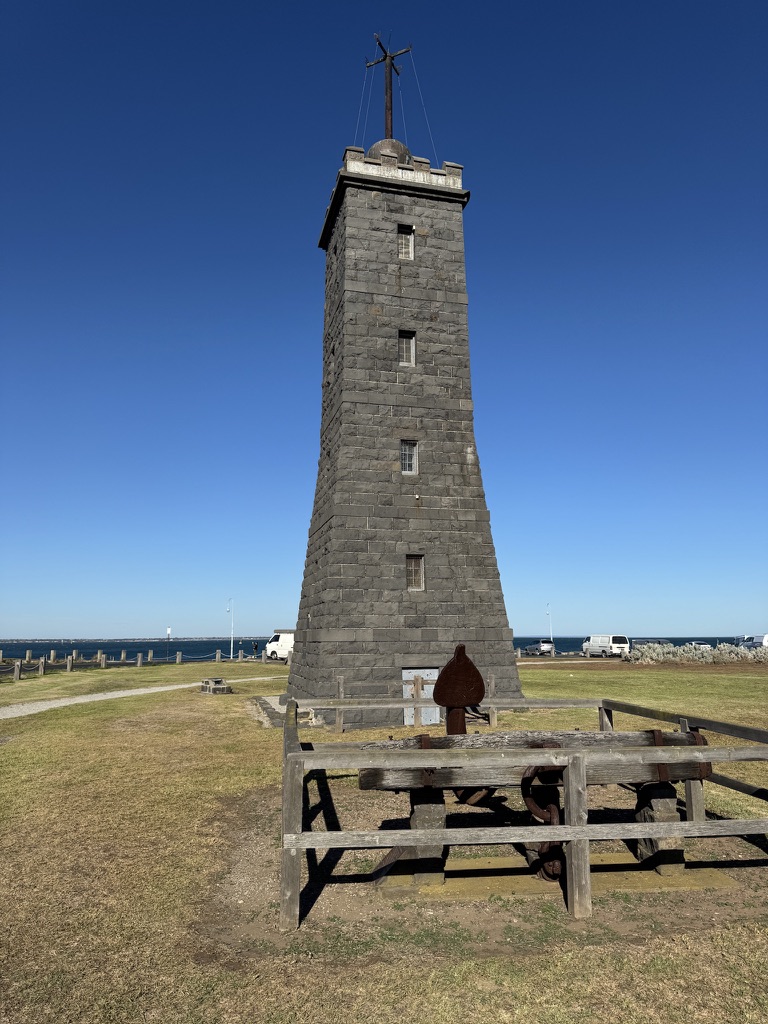
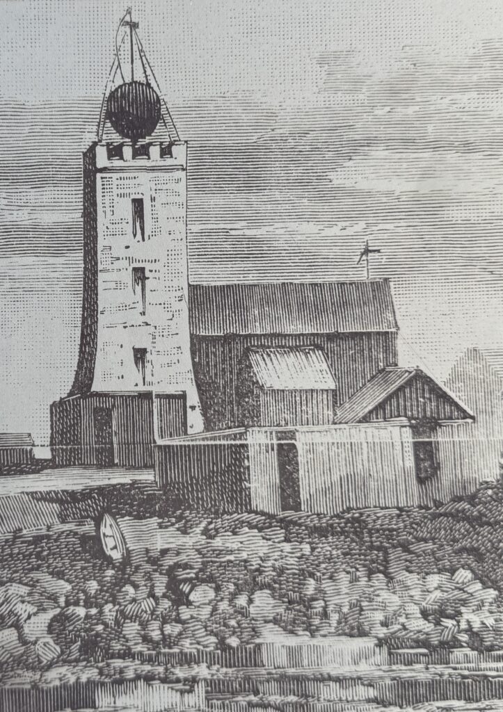
The Williamstown Time Ball Tower:
The Williamstown Time Ball Tower represents a unique fusion of lighthouse and chronometer technology. The Williamstown tower was built in 1849 of local bluestone. It was originally a lighthouse, and later served as a timeball tower from 1861 to 1926.
It was timber skeletal structure on a bluestone base with a fixed white light and claimed a visibility of 5 leagues (approx 15 miles). The cost of construction was £50. A further £85 was allocated for the annual wage of the Keeper, demonstrating the significant investment colonial authorities made in maritime safety infrastructure.
The Williamstown Lighthouse at Gellibrand Point outside of Melbourne was replaced only a decade after its construction in 1852. It was then adopted by the Williamstown Observatory astronomers who turned it into a timeball tower. The time ball system allowed ship captains to synchronize their chronometers—essential for accurate navigation in an era before radio time signals.
The dual function reflects the practical colonial approach to expensive infrastructure, where structures were adapted and repurposed rather than abandoned when their original function was superseded by technological advancement.
Network Integration and Evolution
The Port Phillip Bay lighthouse network demonstrates sophisticated understanding of harbor navigation challenges. Rather than individual beacons operating in isolation, the system comprised interconnected elements: leading lights creating precise channels, pile lights marking specific hazards, coastal lighthouses providing broad guidance, and specialized facilities like the time ball tower supporting the technical requirements of navigation.
This comprehensive approach evolved through decades of maritime disasters, technological advancement, and growing understanding of the bay’s complex hydrodynamics. From the crude oil lamps of the 1850s through gas lighting, electric illumination, and modern LED systems, the network adapted while maintaining its essential function of guiding vessels safely through one of the southern hemisphere’s most challenging harbor approaches.
The transition from manned to automated operations, completed across most facilities by the late 20th century, marked the end of the lighthouse keeper era but ensured the continuation of essential navigational services. Today, under the management of Port of Melbourne Corporation and Ports Victoria, these historic structures continue their vigil while serving as monuments to the maritime heritage that shaped modern Melbourne.
Technical Specifications Summary
Point Lonsdale Lighthouse
- First Exhibited: 1852 (current tower 1902)
- Status: Active
- Construction: Concrete, 22m height
- Range: 14 nautical miles (white), 7 nautical miles (red)
- Character: Flashing (2) every 15 seconds
- Heritage Status: Victorian Heritage Register
Port Melbourne Leading Lights
- First Exhibited: 1924
- Rear Light: 26m concrete tower, red occulting every 6 seconds
- Front Light: Wooden-framed on piles (inactive)
- Heritage Status: Victorian Heritage Register (1995)
West Channel Pile Light
- Built: 1881
- Structure: Two-storey octagonal on piles
- Heritage Status: Victorian Heritage Register
McCrae (Eastern) Lighthouse
- Built: 1874 (England), erected 1883
- Height: 33.5 meters (Victoria’s tallest lighthouse)
- Status: Decommissioned
South Channel Pile Light
- Established: 1874
- Status: Relocated and preserved
- Function: Front light for South Channel system
Williamstown Time Ball Tower
- Built: 1849, Time Ball service 1861-1926
- Construction: Bluestone, 27m height
- Status: Heritage monument
Leave a Reply


")