

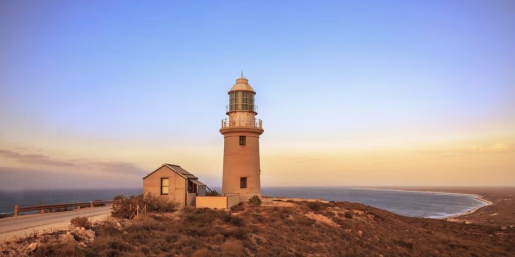
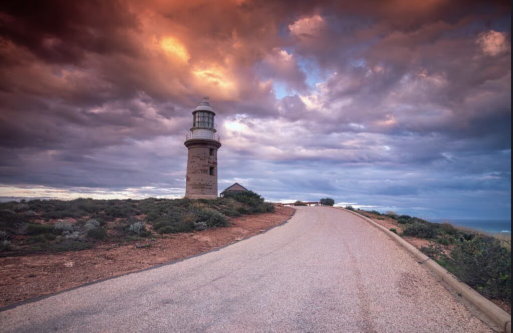
Vlamingh Head Lighthouse stands on the northwestern extremity of North West Cape, 17 kilometres north of Exmouth, overlooking Lighthouse Bay where the dramatic red cliffs of Cape Range meet the crystalline waters of the Indian Ocean. This remote lighthouse has guided vessels along one of the world’s most treacherous stretches of coastline for over a century, marking the approaches to the Ningaloo Coast and serving the vital shipping routes between Fremantle, the northwest ports, and the waters of the Indian Ocean and points north.
The headland itself was charted in 1696 by Dutch explorer Willem de Vlamingh, whose countryman Haevik Claezoon van Hillegom had made the first recorded European sighting of this part of Australia in 1618. In 1801 the French explorer Nicolas Baudin named the area Cape Murat during his expedition to map Australia’s coastline. Today, this spectacular location sits on the traditional lands of the Yinikutira people, also known as the Jinigudira, who have inhabited this country for at least 30,000 years and likely much longer, maintaining deep cultural connections to this dramatic stretch of coastline known as Palyadi Manu.
By the early twentieth century the northwest coast of Australia had earned its reputation as one of the most hazardous stretches of coast in the world. The dangerous reefs, powerful currents, and maze of islands posed extreme dangers to the growing maritime traffic serving the region’s pearling industry and remote settlements. In 1907 a board of enquiry was established and the captains of numerous coastal vessels were questioned to obtain their views on the best sites for lighthouse construction.
From this enquiry four locations were initially selected where lighthouses would be built. However, the catastrophic wreck of the cattle steamer SS Mildura off Point Murat in 1907 which resulted in the loss of all livestock aboard though fortunately no human lives, brought urgent attention to the need for navigational aids at North West Cape. Though Vlamingh Head had been proposed by several ships’ masters to the Board of Enquiry it had not initially gained sufficient support. Following the Mildura disaster shipping authorities recognized the critical need for a lighthouse at this location.


In 1909 the Harbour and Lights Department announced that a lighthouse would be constructed at Vlamingh Head becoming the fifth lighthouse to be built along this stretch of coast. Construction commenced in November 1911 but the project would face significant challenges that tested the resilience of both the workforce and the project managers.
The remote location demanded that all building materials and supplies be transported by sea from Fremantle, a journey of over 1,200 kilometres along the Western Australian coast. The construction site itself presented harsh conditions with bad drinking water proving to be a serious problem. Outbreaks of dysentery swept through the labourers causing debilitating illness and the death of several labourers.
Despite these hardships construction proceeded and Vlamingh Head Lighthouse was commissioned on 10 November 1912 joining the network of lighthouses along Western Australia’s northwest coast. The lighthouse represented a different construction approach than the prefabricated cast iron towers used elsewhere on the coast.
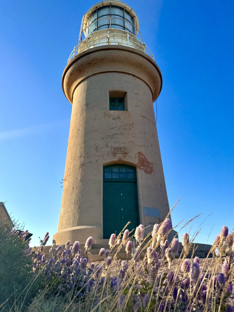
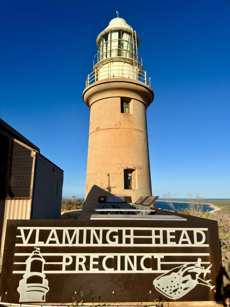
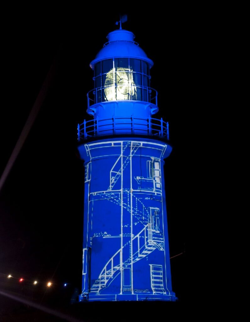
The tower was constructed from shuttered stone with a mortar fill which was then rendered creating a robust structure capable of withstanding the cyclonic conditions that periodically swept across North West Cape. Standing approximately 12 metres tall and positioned 61 metres above sea level the tower was topped with a prefabricated steel and glass lantern that housed the optical apparatus.
The light was fueled by kerosene and produced a distinctive characteristic of two white flashes every 7.5 seconds (Fl.(2) W. 7.5s), visible for up to 22 nautical miles in clear conditions. This powerful beam swept across the approaches to the Ningaloo Coast guiding mariners through the treacherous waters where coral reefs lay hidden beneath turquoise waters.
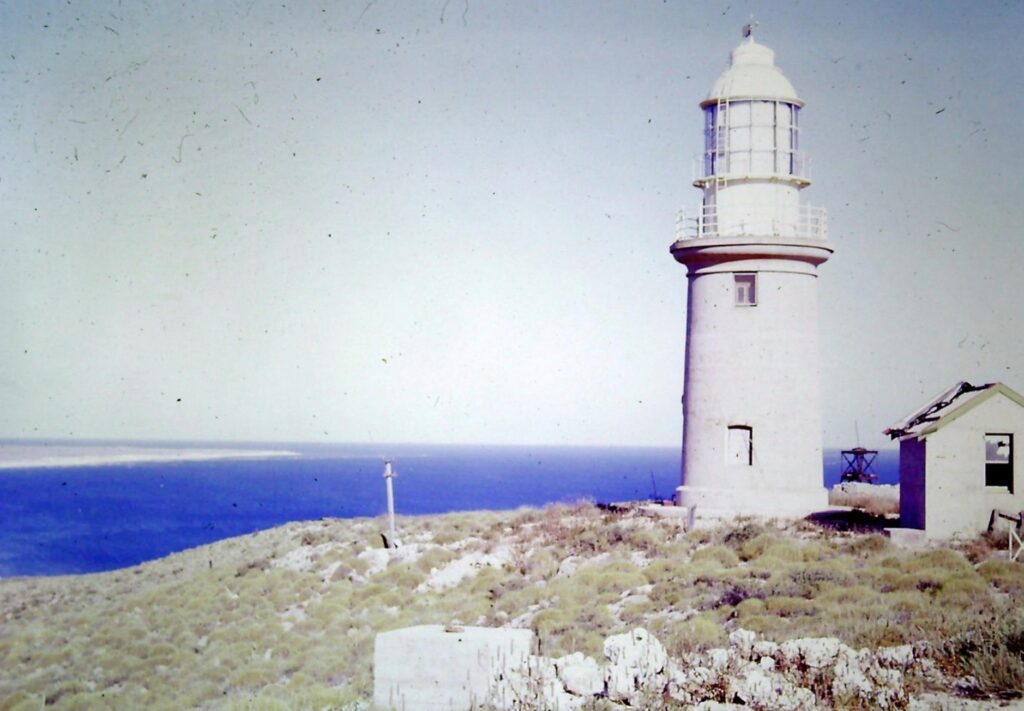
The operation of the lighthouse required two lighthouse keepers who maintained constant vigilance ensuring the light remained burning throughout the hours of darkness. Quarters were built nearby to house the keepers and their families. Life at the station demanded resilience and self-sufficiency with families depending on irregular supply ships for provisions.
Supplies of fuel and provisions for the keepers were landed on the beach and transported to the lighthouse site by horse-drawn carriages on a tramway a supply system common to many remote lighthouse stations of the era. This infrastructure allowed keepers to maintain operations despite the extreme isolation of their posting where the nearest settlement was many kilometres away across rough terrain.
The sparse and bleak setting on the North West Cape peninsula was typical for the positioning of a lighthouse chosen for its commanding views rather than for the comfort of its inhabitants. The keepers and their families lived far removed from the conveniences of civilisation, their lives governed by the rhythm of the light and the arrival of supply vessels.
The outbreak of World War II brought dramatic changes to North West Cape. The strategic importance of this location commanding the approaches to the northwest coast and the shipping routes to Asia was quickly recognised. A radar station was established near the lighthouse with associated anti-aircraft positions built to defend this vital installation. The radar tower became an important part of Australia’s coastal defence network providing early warning of approaching vessels and aircraft.
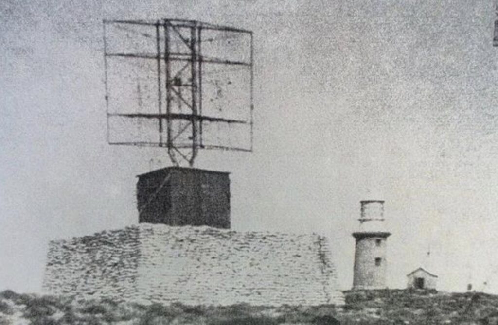
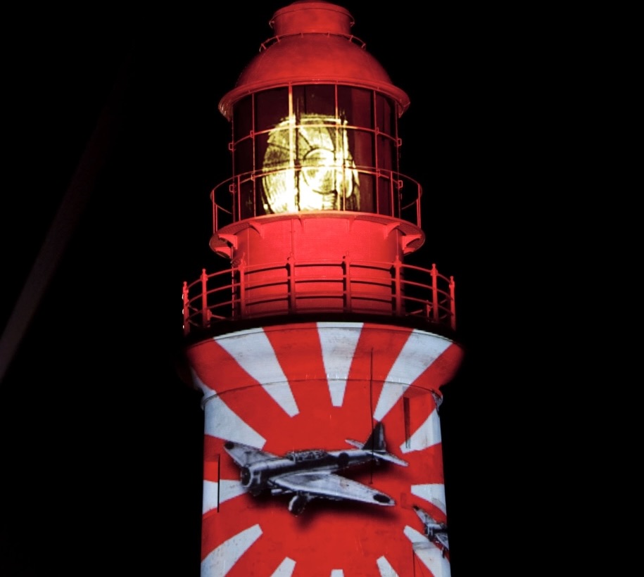
In 1943 this remote outpost came under direct attack when Japanese forces conducted a raid that struck the radar tower bringing the reality of global conflict to this isolated corner of Australia. Despite this attack the lighthouse and its associated military installations continued to operate throughout the war serving both navigational and defensive purposes.
In 1953 a devastating cyclone swept across North West Cape causing considerable damage to both the airbase at Learmonth and the radar station. The lighthouse itself and the keepers’ quarters suffered extensive damage from the powerful winds and driving rain. The keepers themselves undertook much of the repair work demonstrating the self reliance and resourcefulness that characterised life at remote lighthouse stations.
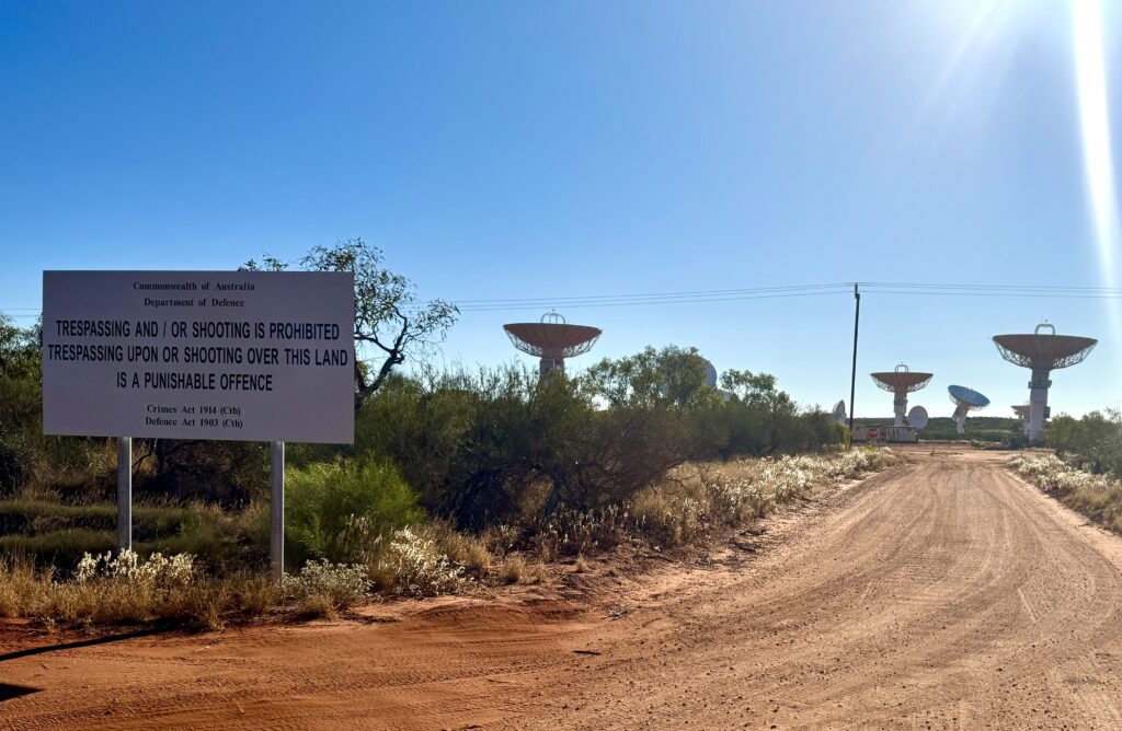
The march of progress and changing strategic priorities brought further transformation to North West Cape in the 1960s. Six kilometres south of the lighthouse the United States Navy established Naval Communication Station Harold E. Holt, a Very Low Frequency (VLF) transmission facility featuring massive antenna towers reaching over 500 feet into the sky. The station was built to provide communication to Allied ships and submarines in the western Pacific and Indian Ocean and the town of Exmouth itself was established at the same time to house personnel and their families.
The lighthouse operated continuously for 55 years until 1967 when technological advances and the construction of the naval communication station brought changes to navigational aids in the area. The light was discontinued and replaced by a new light established on Tower 11 of the naval communication facility at Point Murat which provided greater elevation and visibility for modern shipping.

Following its decommissioning the lighthouse and its quarters fell silent. The buildings that had housed generations of keepers and their families stood empty gradually weathering under the harsh tropical sun and intense winds. The lighthouse tower remains standing as a monument to the era of manned lighthouses and the dedication of those who had kept the light burning.
In 2001, recognising the it’s historical significance restoration efforts began to return the lighthouse to its original operating condition. The restoration was carried out with great care and attention to historical accuracy ensuring that visitors could experience the lighthouse much as it had appeared during its operational years.
In 2012, a special centenary celebration marked 100 years of service by Vlamingh Head Lighthouse. The highlight of the celebration came when the original lens was lit with kerosene recreating the brilliant flash that had guided mariners for over half a century. The event brought together historians, former lighthouse personnel and members of the local community to honour the lighthouse’s vital role in maritime safety.


The heritage significance of Vlamingh Head Lighthouse has been formally recognised through its inclusion in the State Register of Heritage Places and the Register of the National Estate, acknowledging its aesthetic, historic, social, scientific, and cultural importance.
The lighthouse continues to serve as an iconic landmark visible from Exmouth and across the North West Cape its white tower standing in stark contrast to the red earth and blue waters that surround it. It remains a testament to the vision and determination of those who built Australia’s lighthouse network, the resilience of the keepers who maintained the lights, and the enduring importance of maritime safety along one of the world’s most challenging coastlines.
Technical Specifications
First Exhibited: 10 November 1912
Status: Inactive (Decommissioned 1967)
Location: Vlamingh Head, North West Cape, 17 kilometres north of Exmouth, Western Australia
Named After: Willem de Vlamingh, Dutch explorer who charted the headland (1696)
Traditional Owners: Yinikutira (Jinigudira) people – West Thalanyji language group
Aboriginal Name for North West Cape: Palyadi Manu
Construction
Construction Period: November 1911 – November 1912
Construction Material: Shuttered stone with mortar fill, rendered exterior
Lantern: Prefabricated steel and glass
Tower Height: Approximately 12 metres (40 feet)
Elevation: 61 metres above sea level
Construction Challenges:
- All materials transported by sea from Fremantle (1,200+ km)
- Bad drinking water at construction site
- Outbreaks of dysentery among labourers
- One fatality: F.J. Reddy (May 1912)
Associated Infrastructure:
- Small separate rendered stone building with iron roof
- Tramway system for landing supplies (horse-drawn carriages)
- Beach landing facilities
Keeper Accommodation
Original Quarters: Built near lighthouse below the hill to the north
Keepers Required: Two lighthouse keepers and families
Living Conditions: Remote, isolated tropical environment requiring self-sufficiency
Supply System: Provisions and fuel transported from beach via horse-drawn tramway
Light Apparatus
Original Light Source: Kerosene burner
Original Characteristic: Group of two white flashes every 7.5 seconds [Fl.(2) W. 7.5s]
Visibility: 22 nautical miles (nominal range in clear conditions)
Alternative Source: Up to 41 kilometres (25 miles) visibility reported
Operation: Manual operation requiring constant attendance by two keepers
Operational History
Commissioned: 10 November 1912
Decommissioned: 1967
Years of Service: 55 years
Replaced By: Light on Tower 11, US Naval Communications VLF site, Point Murat (Naval Communication Station Harold E. Holt)
Wartime Service
World War II:
- Radar station established near lighthouse
- Anti-aircraft positions constructed
- 1943: Japanese raid struck radar tower
- Continued operations throughout the war
1953 Cyclone:
- Extensive damage to lighthouse and quarters
- Considerable damage to radar station and Learmonth airbase
- Keepers performed much of the repair work
Post-Operational History
1967-2001: Lighthouse and quarters vacant and deteriorating
2001: Restoration to original operating condition
2012: Centenary celebration with original lens lit with kerosene
Heritage Recognition
Heritage Listings:
- State Register of Heritage Places (Heritage Council of Western Australia)
- Register of the National Estate
- Heritage of Western Australia Act 1990
Heritage Significance:
- Aesthetic, historic, social, scientific, and cultural heritage significance
- Significant feature of northwest coast for 50 years
- Notable architecture in remote location
- Evidence of way of life no longer practiced
- Associated with SS Mildura shipwreck (1907) and World War II defence
Current Status
Management: Heritage Council of Western Australia
Access: Lighthouse grounds open year-round; tower not open to public
Use: Tourist attraction and scenic viewpoint
Facilities: Interpretive displays, observation areas, preserved wartime structures
Site Features
Visible Structures:
- Original lighthouse tower (rendered stone)
- Ruins of World War II radar tower
- Preserved wartime sandbags and anti-aircraft positions
- Interpretive signage and displays
- Tramway remains
Natural Features:
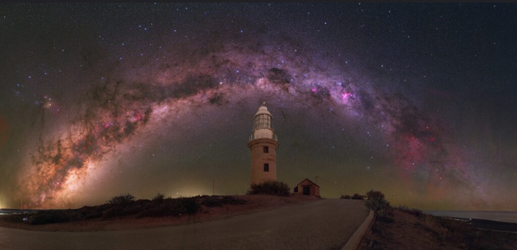
- 360-degree panoramic views
- One of few Australian locations where both sunrise and sunset visible
- Overlooks Lighthouse Bay and Ningaloo Reef
- Excellent whale-watching vantage point (migration seasons)
- Views of Harold E. Holt Naval Communication Station antenna array
Associated Historical Sites
SS Mildura Wreck Site:
- 1907 cattle steamer wreck at Point Murat
- Visible from shore
- Catalyst for lighthouse construction
- Lost all livestock; no human casualties
Naval Communication Station Harold E. Holt:
- Established 1960s, 6 kilometres south of lighthouse
- VLF (Very Low Frequency) transmission facility
- Tower Zero: one of largest towers in southern hemisphere
- 13 towers over 500 feet tall
- Provides communication to Allied vessels in western Pacific and Indian Ocean
- Town of Exmouth established contemporaneously
Visitor Information
Location: 17 kilometres north of Exmouth on Yardie Creek Road
Distance from Exmouth: Approximately 15-20 minutes drive
Park Access: Outside Cape Range National Park boundaries (no park pass required)
Best Times to Visit:
- Sunrise (fewer visitors)
- Sunset (popular, can be crowded)
- Whale migration seasons: Autumn (northward) and Spring (southward)
Viewing Points:
- Lighthouse grounds and observation areas
- Reader Head Lookout (lighthouse visible from distance)
- Various vantage points along North West Cape
Photography: Excellent location for landscape, sunrise/sunset, and whale photography
Aboriginal Cultural Heritage
Traditional Custodians: Yinikutira (also recorded as Jinigudira, West Thalanyji-Yinigudara)
Cultural Significance:
- Part of Gnulli Native Title Claim
- Over 140 protected Aboriginal sites in Ningaloo area
- Evidence of occupation dating back at least 30,000 years, possibly 60,000+ years
- 32,000-year-old shell beaded necklace found at nearby Mandu Mandu Creek Rock Shelter (oldest known Aboriginal jewellery in Australia)
- Sacred burial sites, ceremonial areas, mythological sites, and artefact scatters throughout region
Cultural Practices: Traditional hunting, fishing, gathering, camping, ceremonies, and spiritual connections continue through descendant communities represented by North West Cape Exmouth Aboriginal Corporation (NWCEAC)
Historical Context
Regional Development:
- Part of northwest coast lighthouse network (early 20th century)
- Served pearling industry and remote settlements
- Associated with development of Exmouth and US-Australian defence cooperation
- Located within UNESCO World Heritage-listed Ningaloo Coast area (designated 2011)
Maritime Heritage:
- One of ten lighthouses built on WA coast between 1900-1913
- Represents unique construction method (rendered stone) compared to cast iron prefabricated towers
- Part of network addressing “most hazardous stretch of coast in the world”
- Witness to century of maritime activity along northwest coast
Leave a Reply


")